U59A Littleton, NC, USA - Earthquake Result Viewer
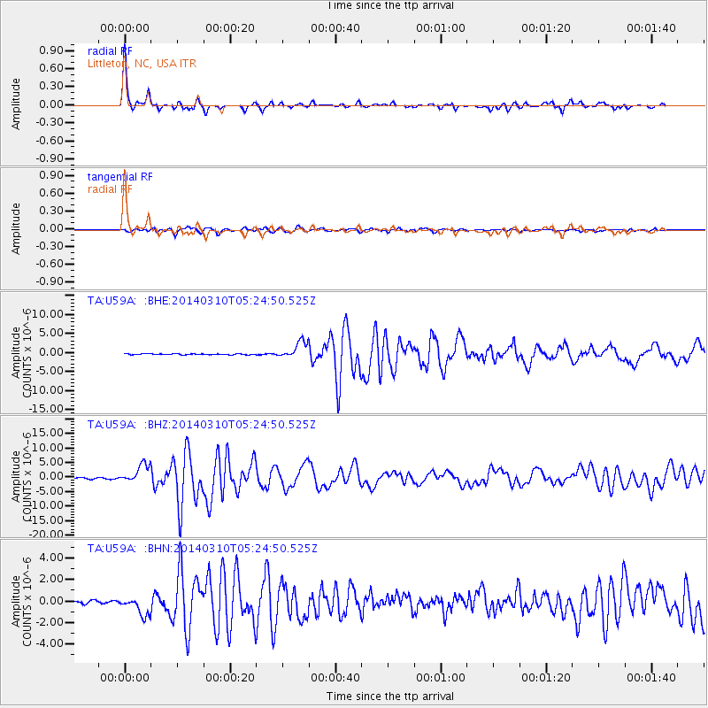
Earthquake location: Off Coast Of Northern California
Earthquake latitude/longitude: 40.8/-125.1
Earthquake time(UTC): 2014/03/10 (069) 05:18:13 GMT
Earthquake Depth: 17 km
Earthquake Magnitude: 6.8 MW, 6.8 MWR, 6.9 MWW, 6.9 MWB, 7.0 MI, 7.0 MWC
Earthquake Catalog/Contributor: NEIC PDE/NEIC COMCAT
Network: TA USArray Transportable Network (new EarthScope stations)
Station: U59A Littleton, NC, USA
Lat/Lon: 36.35 N/77.79 W
Elevation: 99 m
Distance: 36.9 deg
Az: 81.232 deg
Baz: 291.72 deg
Ray Param: 0.07640216
Estimated Moho Depth: 35.25 km
Estimated Crust Vp/Vs: 1.79
Assumed Crust Vp: 6.565 km/s
Estimated Crust Vs: 3.678 km/s
Estimated Crust Poisson's Ratio: 0.27
Radial Match: 96.387344 %
Radial Bump: 270
Transverse Match: 87.48244 %
Transverse Bump: 400
SOD ConfigId: 626651
Insert Time: 2014-04-21 03:18:59.066 +0000
GWidth: 2.5
Max Bumps: 400
Tol: 0.001

Signal To Noise

ChannelStoNSTALTA
TA:U59A: :BHZ:20140310T05:24:50.525Z12.7026623.2447986E-62.554424E-7
TA:U59A: :BHN:20140310T05:24:50.525Z7.21503939.014731E-71.2494361E-7
TA:U59A: :BHE:20140310T05:24:50.525Z17.8598212.2290294E-61.2480692E-7
Arrivals
Ps4.6 SECOND
PpPs14 SECOND
PsPs/PpSs18 SECOND