
V54A Nebo, NC, USA - Earthquake Result Viewer
| ||||||||||||||||||
| ||||||||||||||||||
| ||||||||||||||||||
|
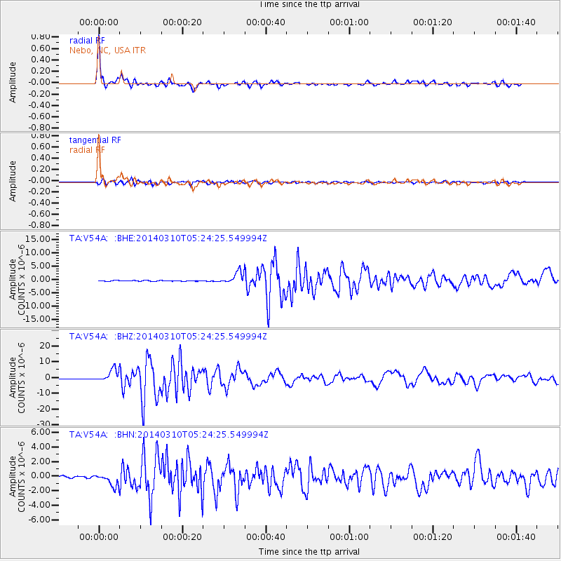
Signal To Noise
| Channel | StoN | STA | LTA |
| TA:V54A: :BHZ:20140310T05:24:25.549994Z | 24.056074 | 4.114672E-6 | 1.7104503E-7 |
| TA:V54A: :BHN:20140310T05:24:25.549994Z | 7.9923153 | 8.8745554E-7 | 1.110386E-7 |
| TA:V54A: :BHE:20140310T05:24:25.549994Z | 17.32567 | 2.3515533E-6 | 1.3572655E-7 |
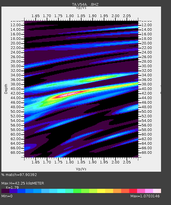
| Arrivals | |
| Ps | 5.6 SECOND |
| PpPs | 17 SECOND |
| PsPs/PpSs | 23 SECOND |

