V62A Hyde County Airport, Englehard, NC, USA - Earthquake Result Viewer
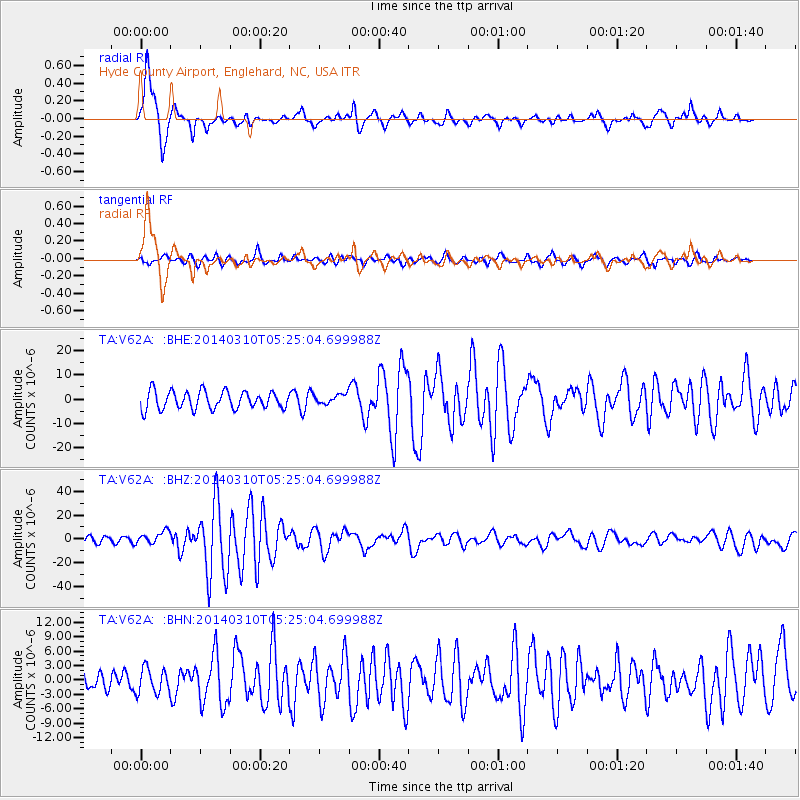
Earthquake location: Off Coast Of Northern California
Earthquake latitude/longitude: 40.8/-125.1
Earthquake time(UTC): 2014/03/10 (069) 05:18:13 GMT
Earthquake Depth: 17 km
Earthquake Magnitude: 6.8 MW, 6.8 MWR, 6.9 MWW, 6.9 MWB, 7.0 MI, 7.0 MWC
Earthquake Catalog/Contributor: NEIC PDE/NEIC COMCAT
Network: TA USArray Transportable Network (new EarthScope stations)
Station: V62A Hyde County Airport, Englehard, NC, USA
Lat/Lon: 35.56 N/75.96 W
Elevation: -3.0 m
Distance: 38.6 deg
Az: 81.499 deg
Baz: 293.004 deg
Ray Param: 0.07545306
Estimated Moho Depth: 14.75 km
Estimated Crust Vp/Vs: 1.79
Assumed Crust Vp: 5.738 km/s
Estimated Crust Vs: 3.206 km/s
Estimated Crust Poisson's Ratio: 0.27
Radial Match: 90.11927 %
Radial Bump: 400
Transverse Match: 79.526474 %
Transverse Bump: 400
SOD ConfigId: 626651
Insert Time: 2014-04-21 03:19:28.103 +0000
GWidth: 2.5
Max Bumps: 400
Tol: 0.001

Signal To Noise

ChannelStoNSTALTA
TA:V62A: :BHZ:20140310T05:25:04.699988Z2.52243615.2712107E-62.08973E-6
TA:V62A: :BHN:20140310T05:25:04.699988Z0.88810052.5992013E-62.9266973E-6
TA:V62A: :BHE:20140310T05:25:04.699988Z0.53517081.956917E-63.6566216E-6
Arrivals
Ps2.1 SECOND
PpPs6.8 SECOND
PsPs/PpSs8.9 SECOND