W57A Gilead, NC, USA - Earthquake Result Viewer
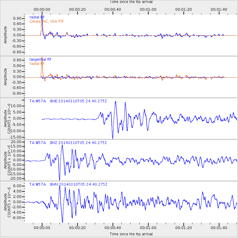
Earthquake location: Off Coast Of Northern California
Earthquake latitude/longitude: 40.8/-125.1
Earthquake time(UTC): 2014/03/10 (069) 05:18:13 GMT
Earthquake Depth: 17 km
Earthquake Magnitude: 6.8 MW, 6.8 MWR, 6.9 MWW, 6.9 MWB, 7.0 MI, 7.0 MWC
Earthquake Catalog/Contributor: NEIC PDE/NEIC COMCAT
Network: TA USArray Transportable Network (new EarthScope stations)
Station: W57A Gilead, NC, USA
Lat/Lon: 35.15 N/79.99 W
Elevation: 85 m
Distance: 35.7 deg
Az: 84.248 deg
Baz: 292.87 deg
Ray Param: 0.07705673
Estimated Moho Depth: 36.25 km
Estimated Crust Vp/Vs: 1.76
Assumed Crust Vp: 6.565 km/s
Estimated Crust Vs: 3.735 km/s
Estimated Crust Poisson's Ratio: 0.26
Radial Match: 97.27468 %
Radial Bump: 253
Transverse Match: 87.198746 %
Transverse Bump: 400
SOD ConfigId: 626651
Insert Time: 2014-04-21 03:19:36.591 +0000
GWidth: 2.5
Max Bumps: 400
Tol: 0.001

Signal To Noise

ChannelStoNSTALTA
TA:W57A: :BHZ:20140310T05:24:40.275Z19.311873.743557E-61.9384746E-7
TA:W57A: :BHN:20140310T05:24:40.275Z8.9902121.0657512E-61.1854573E-7
TA:W57A: :BHE:20140310T05:24:40.275Z11.4835822.4535077E-62.1365352E-7
Arrivals
Ps4.5 SECOND
PpPs14 SECOND
PsPs/PpSs19 SECOND