W58A Raeford, NC, USA - Earthquake Result Viewer
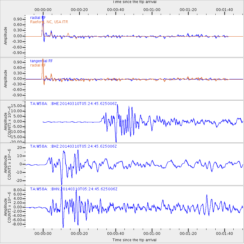
Earthquake location: Off Coast Of Northern California
Earthquake latitude/longitude: 40.8/-125.1
Earthquake time(UTC): 2014/03/10 (069) 05:18:13 GMT
Earthquake Depth: 17 km
Earthquake Magnitude: 6.8 MW, 6.8 MWR, 6.9 MWW, 6.9 MWB, 7.0 MI, 7.0 MWC
Earthquake Catalog/Contributor: NEIC PDE/NEIC COMCAT
Network: TA USArray Transportable Network (new EarthScope stations)
Station: W58A Raeford, NC, USA
Lat/Lon: 35.02 N/79.23 W
Elevation: 84 m
Distance: 36.3 deg
Az: 84.041 deg
Baz: 293.137 deg
Ray Param: 0.076716594
Estimated Moho Depth: 11.75 km
Estimated Crust Vp/Vs: 1.71
Assumed Crust Vp: 6.565 km/s
Estimated Crust Vs: 3.839 km/s
Estimated Crust Poisson's Ratio: 0.24
Radial Match: 96.396935 %
Radial Bump: 356
Transverse Match: 91.03618 %
Transverse Bump: 400
SOD ConfigId: 626651
Insert Time: 2014-04-21 03:19:40.903 +0000
GWidth: 2.5
Max Bumps: 400
Tol: 0.001

Signal To Noise

ChannelStoNSTALTA
TA:W58A: :BHZ:20140310T05:24:45.625006Z13.8680124.1590656E-62.999035E-7
TA:W58A: :BHN:20140310T05:24:45.625006Z10.0320341.2704916E-61.2664346E-7
TA:W58A: :BHE:20140310T05:24:45.625006Z14.058273.0626404E-62.1785327E-7
Arrivals
Ps1.4 SECOND
PpPs4.5 SECOND
PsPs/PpSs5.9 SECOND