
W59A Clinton, NC, USA - Earthquake Result Viewer
| ||||||||||||||||||
| ||||||||||||||||||
| ||||||||||||||||||
|
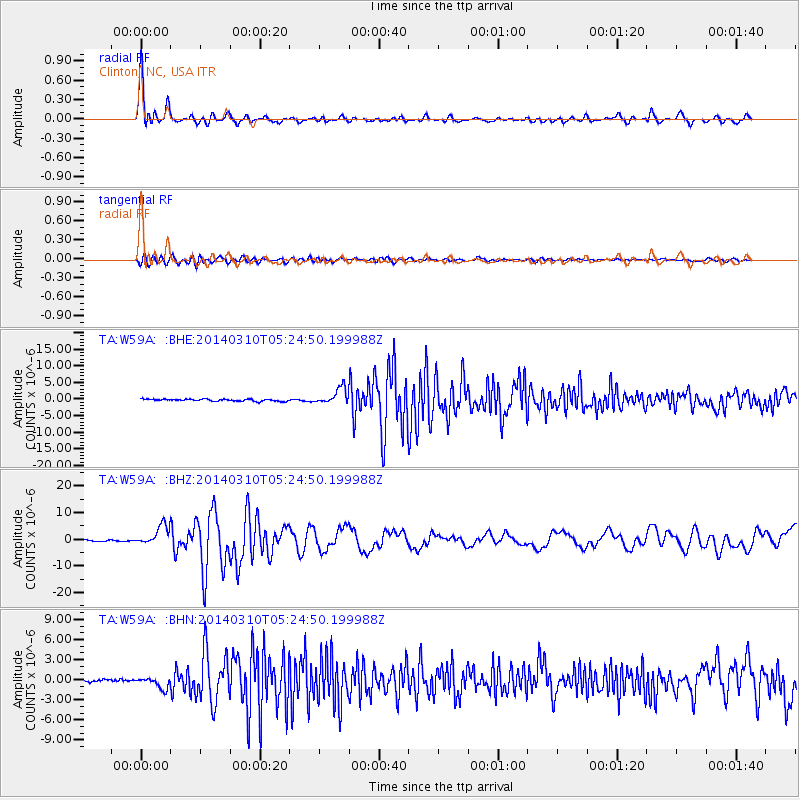
Signal To Noise
| Channel | StoN | STA | LTA |
| TA:W59A: :BHZ:20140310T05:24:50.199988Z | 12.7380295 | 3.6829772E-6 | 2.891324E-7 |
| TA:W59A: :BHN:20140310T05:24:50.199988Z | 3.9708962 | 8.434848E-7 | 2.1241675E-7 |
| TA:W59A: :BHE:20140310T05:24:50.199988Z | 7.870458 | 2.4118522E-6 | 3.064437E-7 |
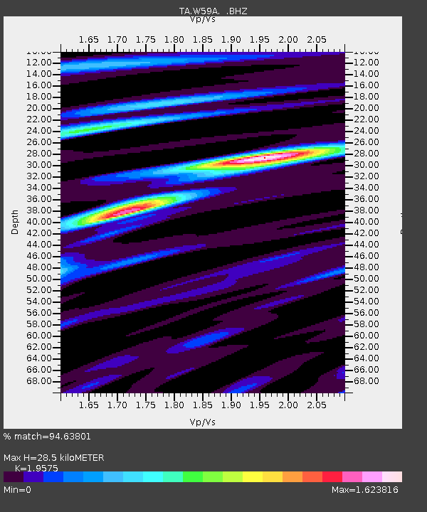
| Arrivals | |
| Ps | 4.5 SECOND |
| PpPs | 12 SECOND |
| PsPs/PpSs | 16 SECOND |

