
X54A Belton, SC, USA - Earthquake Result Viewer
| ||||||||||||||||||
| ||||||||||||||||||
| ||||||||||||||||||
|
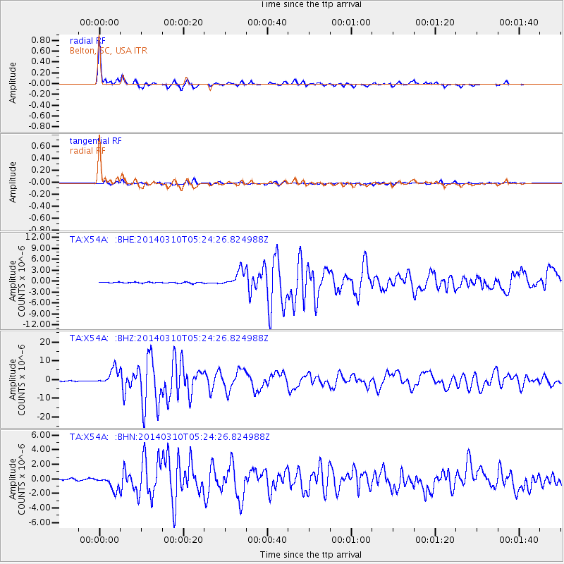
Signal To Noise
| Channel | StoN | STA | LTA |
| TA:X54A: :BHZ:20140310T05:24:26.824988Z | 24.687956 | 4.376755E-6 | 1.77283E-7 |
| TA:X54A: :BHN:20140310T05:24:26.824988Z | 8.363992 | 1.0189739E-6 | 1.2182866E-7 |
| TA:X54A: :BHE:20140310T05:24:26.824988Z | 16.271454 | 2.2918373E-6 | 1.4085018E-7 |
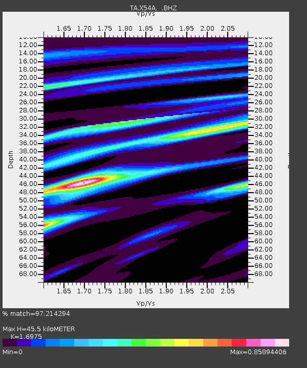
| Arrivals | |
| Ps | 5.4 SECOND |
| PpPs | 18 SECOND |
| PsPs/PpSs | 23 SECOND |

