X60A Albert Glenn Thornton, NC, USA - Earthquake Result Viewer
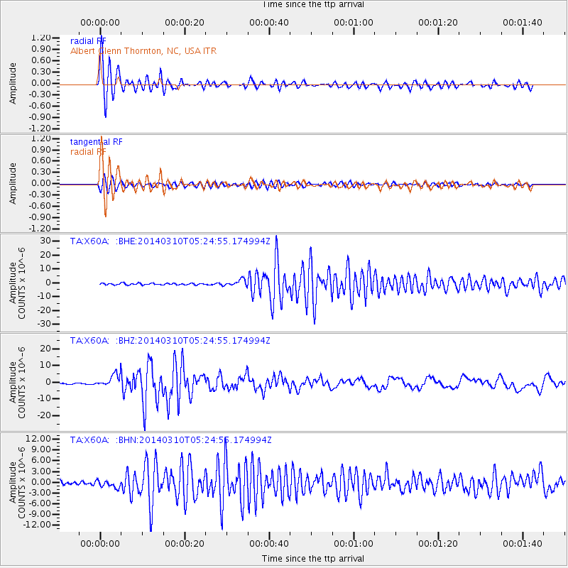
Earthquake location: Off Coast Of Northern California
Earthquake latitude/longitude: 40.8/-125.1
Earthquake time(UTC): 2014/03/10 (069) 05:18:13 GMT
Earthquake Depth: 17 km
Earthquake Magnitude: 6.8 MW, 6.8 MWR, 6.9 MWW, 6.9 MWB, 7.0 MI, 7.0 MWC
Earthquake Catalog/Contributor: NEIC PDE/NEIC COMCAT
Network: TA USArray Transportable Network (new EarthScope stations)
Station: X60A Albert Glenn Thornton, NC, USA
Lat/Lon: 34.58 N/77.98 W
Elevation: 12 m
Distance: 37.5 deg
Az: 84.03 deg
Baz: 293.842 deg
Ray Param: 0.076104075
Estimated Moho Depth: 15.25 km
Estimated Crust Vp/Vs: 1.90
Assumed Crust Vp: 6.565 km/s
Estimated Crust Vs: 3.45 km/s
Estimated Crust Poisson's Ratio: 0.31
Radial Match: 95.38463 %
Radial Bump: 400
Transverse Match: 91.26599 %
Transverse Bump: 400
SOD ConfigId: 626651
Insert Time: 2014-04-21 03:20:07.612 +0000
GWidth: 2.5
Max Bumps: 400
Tol: 0.001

Signal To Noise

ChannelStoNSTALTA
TA:X60A: :BHZ:20140310T05:24:55.174994Z11.8754943.9956476E-63.364616E-7
TA:X60A: :BHN:20140310T05:24:55.174994Z2.17737639.929047E-74.5600967E-7
TA:X60A: :BHE:20140310T05:24:55.174994Z4.10366632.387514E-65.8180024E-7
Arrivals
Ps2.3 SECOND
PpPs6.3 SECOND
PsPs/PpSs8.5 SECOND