
Y52A Lilburn, GA, USA - Earthquake Result Viewer
| ||||||||||||||||||
| ||||||||||||||||||
| ||||||||||||||||||
|
Signal To Noise
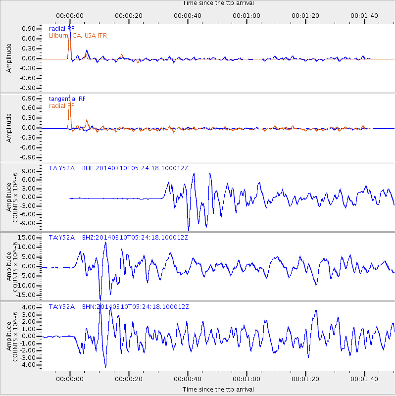
| Channel | StoN | STA | LTA |
| TA:Y52A: :BHZ:20140310T05:24:18.100012Z | 25.884434 | 4.0359228E-6 | 1.5592084E-7 |
| TA:Y52A: :BHN:20140310T05:24:18.100012Z | 17.464846 | 1.1137251E-6 | 6.3769534E-8 |
| TA:Y52A: :BHE:20140310T05:24:18.100012Z | 25.92762 | 2.5220695E-6 | 9.7273464E-8 |
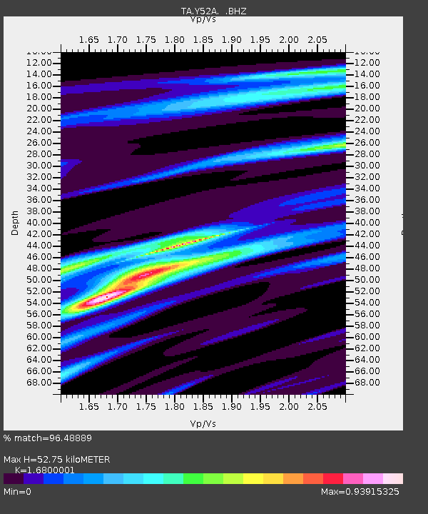
| Arrivals | |
| Ps | 5.8 SECOND |
| PpPs | 19 SECOND |
| PsPs/PpSs | 25 SECOND |

