Y57A Sumter, SC, USA - Earthquake Result Viewer
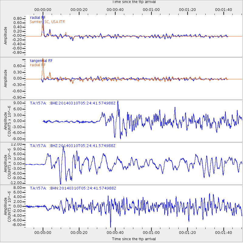
Earthquake location: Off Coast Of Northern California
Earthquake latitude/longitude: 40.8/-125.1
Earthquake time(UTC): 2014/03/10 (069) 05:18:13 GMT
Earthquake Depth: 17 km
Earthquake Magnitude: 6.8 MW, 6.8 MWR, 6.9 MWW, 6.9 MWB, 7.0 MI, 7.0 MWC
Earthquake Catalog/Contributor: NEIC PDE/NEIC COMCAT
Network: TA USArray Transportable Network (new EarthScope stations)
Station: Y57A Sumter, SC, USA
Lat/Lon: 34.02 N/80.39 W
Elevation: 56 m
Distance: 35.9 deg
Az: 86.249 deg
Baz: 294.268 deg
Ray Param: 0.07697432
Estimated Moho Depth: 31.5 km
Estimated Crust Vp/Vs: 1.77
Assumed Crust Vp: 6.419 km/s
Estimated Crust Vs: 3.632 km/s
Estimated Crust Poisson's Ratio: 0.26
Radial Match: 87.589325 %
Radial Bump: 400
Transverse Match: 69.431984 %
Transverse Bump: 400
SOD ConfigId: 626651
Insert Time: 2014-04-21 03:20:16.465 +0000
GWidth: 2.5
Max Bumps: 400
Tol: 0.001

Signal To Noise

ChannelStoNSTALTA
TA:Y57A: :BHZ:20140310T05:24:41.574988Z16.7714713.4867767E-62.0789926E-7
TA:Y57A: :BHN:20140310T05:24:41.574988Z4.2281187.701246E-71.8214358E-7
TA:Y57A: :BHE:20140310T05:24:41.574988Z9.1740442.2152044E-62.4146436E-7
Arrivals
Ps4.1 SECOND
PpPs13 SECOND
PsPs/PpSs17 SECOND