Z59A Georgetown, SC, USA - Earthquake Result Viewer
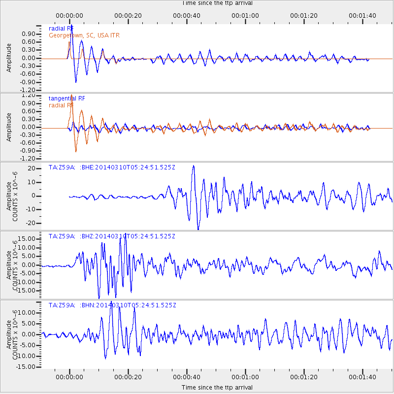
Earthquake location: Off Coast Of Northern California
Earthquake latitude/longitude: 40.8/-125.1
Earthquake time(UTC): 2014/03/10 (069) 05:18:13 GMT
Earthquake Depth: 17 km
Earthquake Magnitude: 6.8 MW, 6.8 MWR, 6.9 MWW, 6.9 MWB, 7.0 MI, 7.0 MWC
Earthquake Catalog/Contributor: NEIC PDE/NEIC COMCAT
Network: TA USArray Transportable Network (new EarthScope stations)
Station: Z59A Georgetown, SC, USA
Lat/Lon: 33.24 N/79.28 W
Elevation: 8.0 m
Distance: 37.0 deg
Az: 86.776 deg
Baz: 295.305 deg
Ray Param: 0.076338336
Estimated Moho Depth: 12.25 km
Estimated Crust Vp/Vs: 1.60
Assumed Crust Vp: 6.24 km/s
Estimated Crust Vs: 3.9 km/s
Estimated Crust Poisson's Ratio: 0.18
Radial Match: 92.4535 %
Radial Bump: 381
Transverse Match: 82.31713 %
Transverse Bump: 380
SOD ConfigId: 626651
Insert Time: 2014-04-21 03:20:35.086 +0000
GWidth: 2.5
Max Bumps: 400
Tol: 0.001

Signal To Noise

ChannelStoNSTALTA
TA:Z59A: :BHZ:20140310T05:24:51.525Z10.4683873.8467774E-63.674661E-7
TA:Z59A: :BHN:20140310T05:24:51.525Z2.32639931.3982849E-66.0105106E-7
TA:Z59A: :BHE:20140310T05:24:51.525Z4.04994343.240101E-68.000361E-7
Arrivals
Ps1.3 SECOND
PpPs4.7 SECOND
PsPs/PpSs6.0 SECOND