
BRAL Brewton, Alabama, USA - Earthquake Result Viewer
| ||||||||||||||||||
| ||||||||||||||||||
| ||||||||||||||||||
|
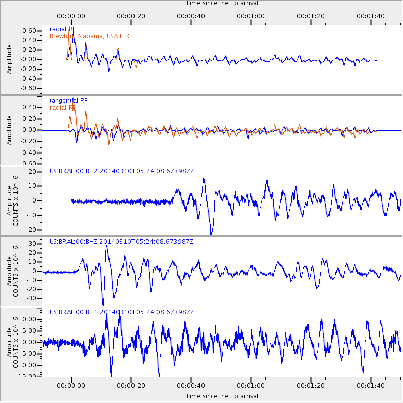
Signal To Noise
| Channel | StoN | STA | LTA |
| US:BRAL:00:BHZ:20140310T05:24:08.673987Z | 15.508327 | 6.004448E-6 | 3.8717576E-7 |
| US:BRAL:00:BH1:20140310T05:24:08.673987Z | 2.2669926 | 1.734798E-6 | 7.65242E-7 |
| US:BRAL:00:BH2:20140310T05:24:08.673987Z | 3.9677618 | 2.8488398E-6 | 7.1799667E-7 |
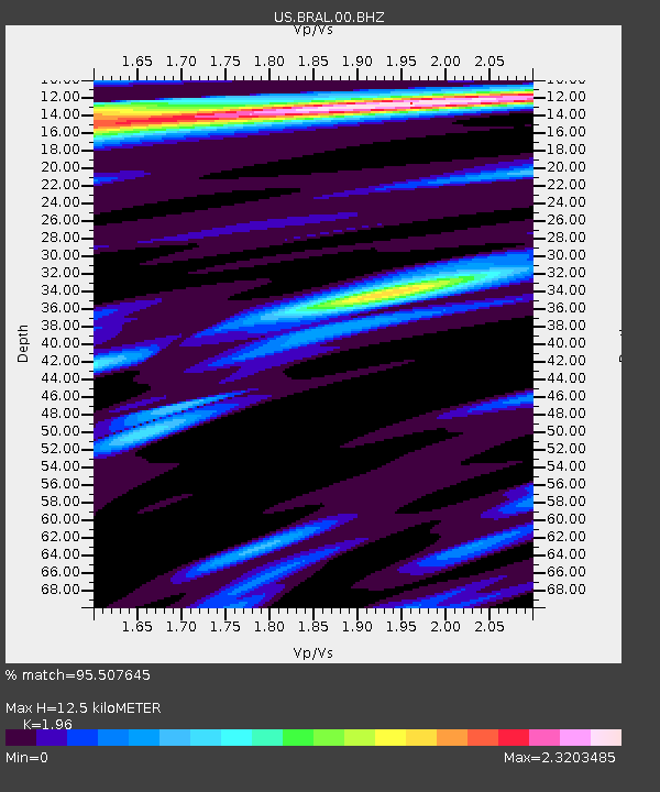
| Arrivals | |
| Ps | 2.1 SECOND |
| PpPs | 5.6 SECOND |
| PsPs/PpSs | 7.7 SECOND |

