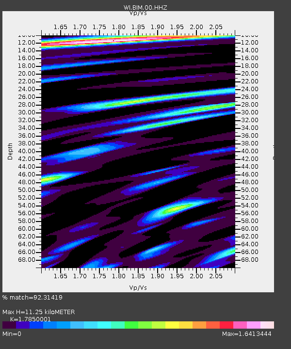
BIM Morne Bigot, Anses d'Arlets, Martinique - Earthquake Result Viewer
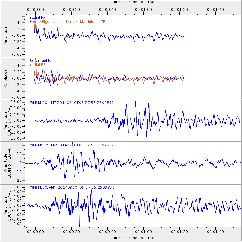
Earthquake location: Off Coast Of Northern California
Earthquake latitude/longitude: 40.8/-125.1
Earthquake time(UTC): 2014/03/10 (069) 05:18:13 GMT
Earthquake Depth: 17 km
Earthquake Magnitude: 6.8 MW, 6.8 MWR, 6.9 MWW, 6.9 MWB, 7.0 MI, 7.0 MWC
Earthquake Catalog/Contributor: NEIC PDE/NEIC COMCAT
Network: WI West Indies IPGP Network
Station: BIM Morne Bigot, Anses d'Arlets, Martinique
Lat/Lon: 14.52 N/61.07 W
Elevation: 391 m
Distance: 61.1 deg
Az: 95.691 deg
Baz: 308.769 deg
Ray Param: 0.06109458
Estimated Moho Depth: 11.25 km
Estimated Crust Vp/Vs: 1.79
Assumed Crust Vp: 5.88 km/s
Estimated Crust Vs: 3.294 km/s
Estimated Crust Poisson's Ratio: 0.27
Radial Match: 92.31419 %
Radial Bump: 400
Transverse Match: 85.74609 %
Transverse Bump: 400
SOD ConfigId: 626651
Insert Time: 2014-04-21 03:21:31.331 +0000
GWidth: 2.5
Max Bumps: 400
Tol: 0.001

Signal To Noise

ChannelStoNSTALTA
WI:BIM:00:HHZ:20140310T05:27:55.259985Z5.59211732.1735327E-63.8867796E-7
WI:BIM:00:HHN:20140310T05:27:55.259985Z0.94538185.049728E-75.3414686E-7
WI:BIM:00:HHE:20140310T05:27:55.259985Z1.65409649.541749E-75.7685565E-7
Arrivals
Ps1.6 SECOND
PpPs5.1 SECOND
PsPs/PpSs6.7 SECOND