You are here: Home > Network List > TA - USArray Transportable Network (new EarthScope stations) Stations List
> Station H17A Grant Village (NPS), Yellowstone Nt. Park, WY, USA > Earthquake Result Viewer
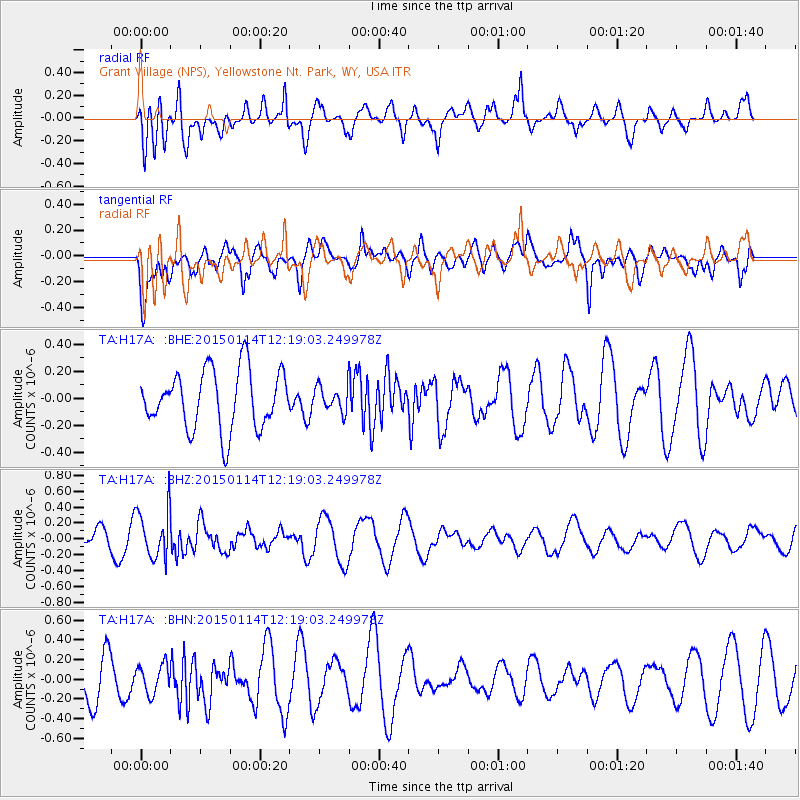
H17A Grant Village (NPS), Yellowstone Nt. Park, WY, USA - Earthquake Result Viewer
*The percent match for this event was below the threshold and hence no stack was calculated.
| Earthquake location: |
Sakhalin, Russia |
| Earthquake latitude/longitude: |
48.9/142.1 |
| Earthquake time(UTC): |
2015/01/14 (014) 12:09:35 GMT |
| Earthquake Depth: |
585 km |
| Earthquake Magnitude: |
5.3 MW, 5.0 mb |
| Earthquake Catalog/Contributor: |
ISC/ISC |
|
| Network: |
TA USArray Transportable Network (new EarthScope stations) |
| Station: |
H17A Grant Village (NPS), Yellowstone Nt. Park, WY, USA |
| Lat/Lon: |
44.40 N/110.58 W |
| Elevation: |
2400 m |
|
| Distance: |
67.5 deg |
| Az: |
47.796 deg |
| Baz: |
316.964 deg |
| Ray Param: |
$rayparam |
*The percent match for this event was below the threshold and hence was not used in the summary stack. |
|
| Radial Match: |
59.744156 % |
| Radial Bump: |
400 |
| Transverse Match: |
64.141205 % |
| Transverse Bump: |
400 |
| SOD ConfigId: |
3390531 |
| Insert Time: |
2019-04-16 01:28:41.559 +0000 |
| GWidth: |
2.5 |
| Max Bumps: |
400 |
| Tol: |
0.001 |
|
Signal To Noise
| Channel | StoN | STA | LTA |
| TA:H17A: :BHZ:20150114T12:19:03.249978Z | 2.11181 | 3.0662335E-7 | 1.4519458E-7 |
| TA:H17A: :BHN:20150114T12:19:03.249978Z | 0.62459797 | 1.4450941E-7 | 2.313639E-7 |
| TA:H17A: :BHE:20150114T12:19:03.249978Z | 0.41856253 | 9.066046E-8 | 2.1659956E-7 |
| Arrivals |
| Ps | |
| PpPs | |
| PsPs/PpSs | |


