You are here: Home > Network List > CN - Canadian National Seismograph Network Stations List
> Station INK INUVIK, NT > Earthquake Result Viewer
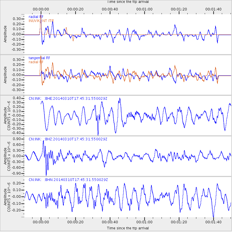
INK INUVIK, NT - Earthquake Result Viewer
*The percent match for this event was below the threshold and hence no stack was calculated.
| Earthquake location: |
Eastern New Guinea Reg., P.N.G. |
| Earthquake latitude/longitude: |
-5.5/148.0 |
| Earthquake time(UTC): |
2014/03/10 (069) 17:33:30 GMT |
| Earthquake Depth: |
269 km |
| Earthquake Magnitude: |
5.9 MWB, 5.9 MWW, 6.0 MWC |
| Earthquake Catalog/Contributor: |
NEIC PDE/NEIC COMCAT |
|
| Network: |
CN Canadian National Seismograph Network |
| Station: |
INK INUVIK, NT |
| Lat/Lon: |
68.31 N/133.53 W |
| Elevation: |
44 m |
|
| Distance: |
90.8 deg |
| Az: |
21.369 deg |
| Baz: |
257.324 deg |
| Ray Param: |
$rayparam |
*The percent match for this event was below the threshold and hence was not used in the summary stack. |
|
| Radial Match: |
44.518253 % |
| Radial Bump: |
400 |
| Transverse Match: |
71.81259 % |
| Transverse Bump: |
400 |
| SOD ConfigId: |
626651 |
| Insert Time: |
2014-04-21 03:28:54.142 +0000 |
| GWidth: |
2.5 |
| Max Bumps: |
400 |
| Tol: |
0.001 |
|
Signal To Noise
| Channel | StoN | STA | LTA |
| CN:INK: :BHZ:20140310T17:45:31.550029Z | 3.194927 | 4.2364124E-7 | 1.325981E-7 |
| CN:INK: :BHN:20140310T17:45:31.550029Z | 0.6791939 | 6.9415286E-8 | 1.0220246E-7 |
| CN:INK: :BHE:20140310T17:45:31.550029Z | 1.0882854 | 1.6766704E-7 | 1.540653E-7 |
| Arrivals |
| Ps | |
| PpPs | |
| PsPs/PpSs | |


