
LPAZ La Paz , Bolivia - Earthquake Result Viewer
| ||||||||||||||||||
| ||||||||||||||||||
| ||||||||||||||||||
|
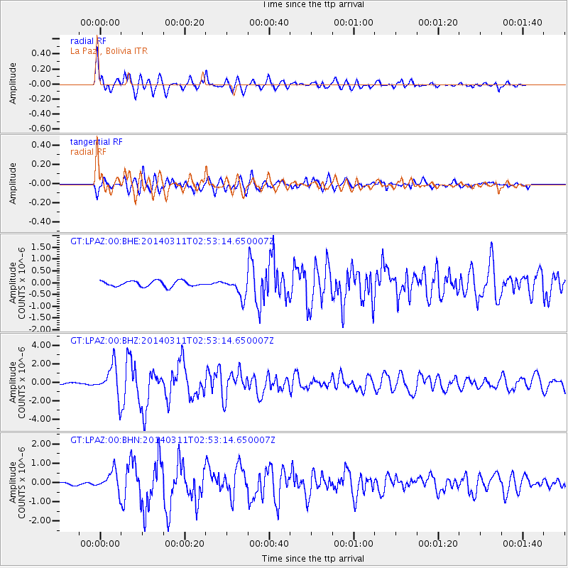
Signal To Noise
| Channel | StoN | STA | LTA |
| GT:LPAZ:00:BHZ:20140311T02:53:14.650007Z | 15.211373 | 1.7581929E-6 | 1.155841E-7 |
| GT:LPAZ:00:BHN:20140311T02:53:14.650007Z | 4.687793 | 5.4438516E-7 | 1.1612825E-7 |
| GT:LPAZ:00:BHE:20140311T02:53:14.650007Z | 4.791708 | 5.5475687E-7 | 1.1577435E-7 |
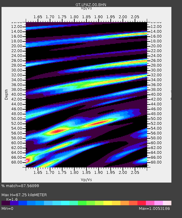
| Arrivals | |
| Ps | 6.6 SECOND |
| PpPs | 26 SECOND |
| PsPs/PpSs | 32 SECOND |

