You are here: Home > Network List > G - GEOSCOPE Stations List
> Station INU Inuyama, Japan > Earthquake Result Viewer
INU Inuyama, Japan - Earthquake Result Viewer
*The percent match for this event was below the threshold and hence no stack was calculated.
| Earthquake location: |
Bismarck Sea |
| Earthquake latitude/longitude: |
-3.1/148.6 |
| Earthquake time(UTC): |
2014/03/11 (070) 22:03:09 GMT |
| Earthquake Depth: |
7.0 km |
| Earthquake Magnitude: |
6.1 MWW, 6.1 MWC, 6.1 MWB, 6.2 MWC |
| Earthquake Catalog/Contributor: |
NEIC PDE/NEIC COMCAT |
|
| Network: |
G GEOSCOPE |
| Station: |
INU Inuyama, Japan |
| Lat/Lon: |
35.35 N/137.03 E |
| Elevation: |
132 m |
|
| Distance: |
39.7 deg |
| Az: |
345.197 deg |
| Baz: |
161.814 deg |
| Ray Param: |
$rayparam |
*The percent match for this event was below the threshold and hence was not used in the summary stack. |
|
| Radial Match: |
74.22651 % |
| Radial Bump: |
361 |
| Transverse Match: |
63.814686 % |
| Transverse Bump: |
400 |
| SOD ConfigId: |
626651 |
| Insert Time: |
2014-04-21 03:46:55.700 +0000 |
| GWidth: |
2.5 |
| Max Bumps: |
400 |
| Tol: |
0.001 |
|
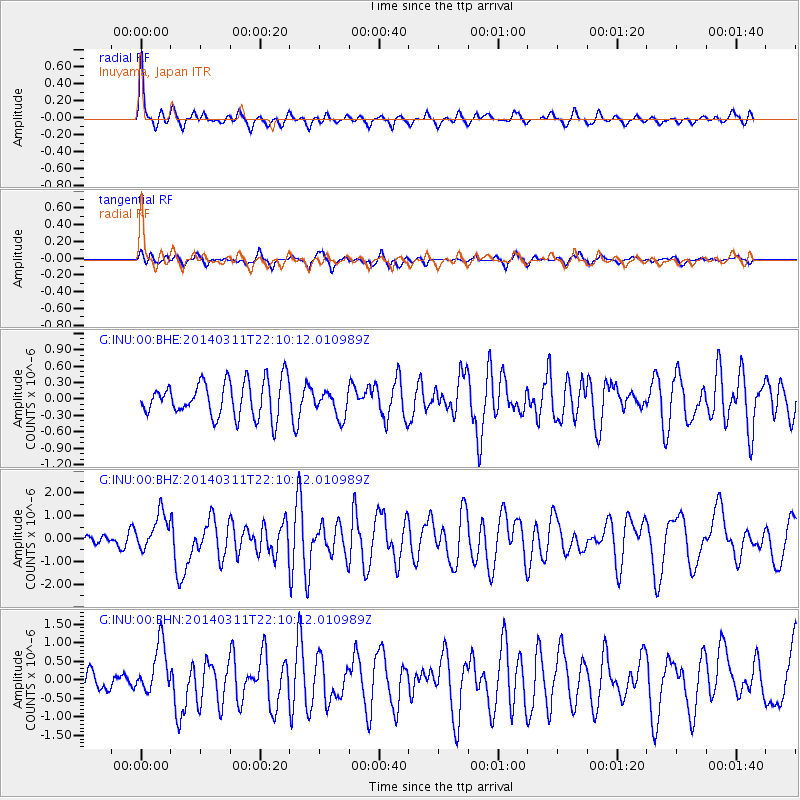
Signal To Noise
| Channel | StoN | STA | LTA |
| G:INU:00:BHZ:20140311T22:10:12.010989Z | 1.8781813 | 8.012045E-7 | 4.2658527E-7 |
| G:INU:00:BHN:20140311T22:10:12.010989Z | 1.9263253 | 6.890961E-7 | 3.5772572E-7 |
| G:INU:00:BHE:20140311T22:10:12.010989Z | 0.76706356 | 2.4871483E-7 | 3.2424282E-7 |
| Arrivals |
| Ps | |
| PpPs | |
| PsPs/PpSs | |


