You are here: Home > Network List > II - Global Seismograph Network (GSN - IRIS/IDA) Stations List
> Station CMLA Cha de Macela, Sao Miguel Island, Azores > Earthquake Result Viewer
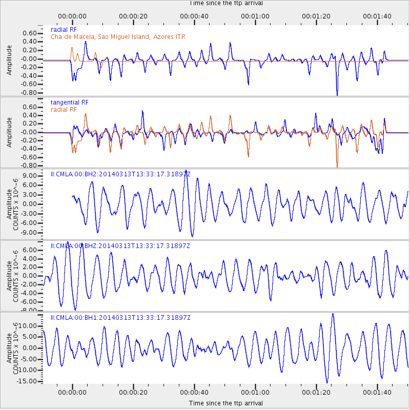
CMLA Cha de Macela, Sao Miguel Island, Azores - Earthquake Result Viewer
*The percent match for this event was below the threshold and hence no stack was calculated.
| Earthquake location: |
Andreanof Islands, Aleutian Is. |
| Earthquake latitude/longitude: |
51.2/-179.1 |
| Earthquake time(UTC): |
2014/03/13 (072) 13:20:59 GMT |
| Earthquake Depth: |
26 km |
| Earthquake Magnitude: |
5.6 MWC, 5.1 ML, 5.4 MWW, 5.4 MWB, 5.5 ML, 5.6 MWC |
| Earthquake Catalog/Contributor: |
NEIC PDE/NEIC COMCAT |
|
| Network: |
II Global Seismograph Network (GSN - IRIS/IDA) |
| Station: |
CMLA Cha de Macela, Sao Miguel Island, Azores |
| Lat/Lon: |
37.76 N/25.52 W |
| Elevation: |
429 m |
|
| Distance: |
88.4 deg |
| Az: |
20.653 deg |
| Baz: |
343.743 deg |
| Ray Param: |
$rayparam |
*The percent match for this event was below the threshold and hence was not used in the summary stack. |
|
| Radial Match: |
50.05247 % |
| Radial Bump: |
324 |
| Transverse Match: |
49.971603 % |
| Transverse Bump: |
400 |
| SOD ConfigId: |
626651 |
| Insert Time: |
2014-04-21 04:02:05.719 +0000 |
| GWidth: |
2.5 |
| Max Bumps: |
400 |
| Tol: |
0.001 |
|
Signal To Noise
| Channel | StoN | STA | LTA |
| II:CMLA:00:BHZ:20140313T13:33:17.31897Z | 2.0189257 | 5.07009E-6 | 2.5112813E-6 |
| II:CMLA:00:BH1:20140313T13:33:17.31897Z | 0.3577528 | 2.2740383E-6 | 6.356451E-6 |
| II:CMLA:00:BH2:20140313T13:33:17.31897Z | 0.7069237 | 2.826016E-6 | 3.9976253E-6 |
| Arrivals |
| Ps | |
| PpPs | |
| PsPs/PpSs | |


