You are here: Home > Network List > NE - New England Seismic Network Stations List
> Station EMMW Machias, ME, USA > Earthquake Result Viewer
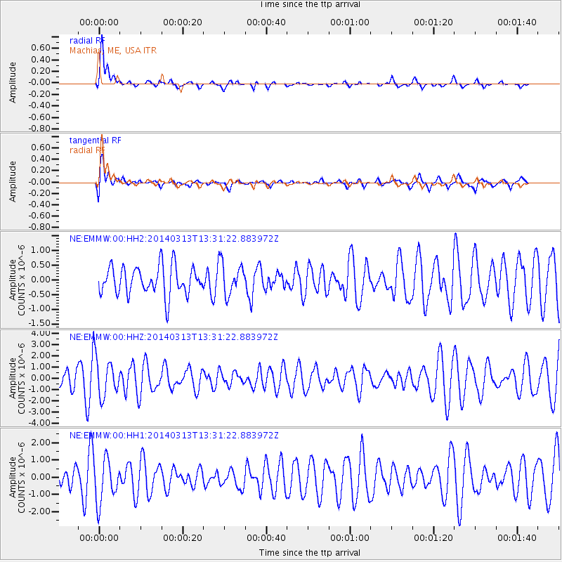
EMMW Machias, ME, USA - Earthquake Result Viewer
*The percent match for this event was below the threshold and hence no stack was calculated.
| Earthquake location: |
Andreanof Islands, Aleutian Is. |
| Earthquake latitude/longitude: |
51.2/-179.1 |
| Earthquake time(UTC): |
2014/03/13 (072) 13:20:59 GMT |
| Earthquake Depth: |
26 km |
| Earthquake Magnitude: |
5.6 MWC, 5.1 ML, 5.4 MWW, 5.4 MWB, 5.5 ML, 5.6 MWC |
| Earthquake Catalog/Contributor: |
NEIC PDE/NEIC COMCAT |
|
| Network: |
NE New England Seismic Network |
| Station: |
EMMW Machias, ME, USA |
| Lat/Lon: |
44.71 N/67.46 W |
| Elevation: |
35 m |
|
| Distance: |
67.7 deg |
| Az: |
45.754 deg |
| Baz: |
320.807 deg |
| Ray Param: |
$rayparam |
*The percent match for this event was below the threshold and hence was not used in the summary stack. |
|
| Radial Match: |
79.68239 % |
| Radial Bump: |
400 |
| Transverse Match: |
78.95103 % |
| Transverse Bump: |
400 |
| SOD ConfigId: |
626651 |
| Insert Time: |
2014-04-21 04:07:35.522 +0000 |
| GWidth: |
2.5 |
| Max Bumps: |
400 |
| Tol: |
0.001 |
|
Signal To Noise
| Channel | StoN | STA | LTA |
| NE:EMMW:00:HHZ:20140313T13:31:22.883972Z | 2.1237555 | 1.5595208E-6 | 7.343222E-7 |
| NE:EMMW:00:HH1:20140313T13:31:22.883972Z | 1.9842066 | 1.2490381E-6 | 6.2948993E-7 |
| NE:EMMW:00:HH2:20140313T13:31:22.883972Z | 1.0631241 | 5.115081E-7 | 4.811368E-7 |
| Arrivals |
| Ps | |
| PpPs | |
| PsPs/PpSs | |


