I61A Oroboro, Fairlee, VT, USA - Earthquake Result Viewer
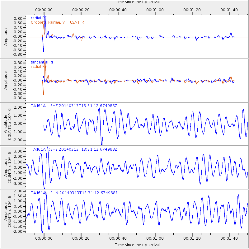
Earthquake location: Andreanof Islands, Aleutian Is.
Earthquake latitude/longitude: 51.2/-179.1
Earthquake time(UTC): 2014/03/13 (072) 13:20:59 GMT
Earthquake Depth: 26 km
Earthquake Magnitude: 5.6 MWC, 5.1 ML, 5.4 MWW, 5.4 MWB, 5.5 ML, 5.6 MWC
Earthquake Catalog/Contributor: NEIC PDE/NEIC COMCAT
Network: TA USArray Transportable Network (new EarthScope stations)
Station: I61A Oroboro, Fairlee, VT, USA
Lat/Lon: 43.93 N/72.21 W
Elevation: 287 m
Distance: 66.1 deg
Az: 49.129 deg
Baz: 318.823 deg
Ray Param: 0.057810873
Estimated Moho Depth: 12.0 km
Estimated Crust Vp/Vs: 2.10
Assumed Crust Vp: 6.419 km/s
Estimated Crust Vs: 3.06 km/s
Estimated Crust Poisson's Ratio: 0.35
Radial Match: 84.60894 %
Radial Bump: 400
Transverse Match: 59.921482 %
Transverse Bump: 400
SOD ConfigId: 626651
Insert Time: 2014-04-21 04:14:24.968 +0000
GWidth: 2.5
Max Bumps: 400
Tol: 0.001

Signal To Noise

ChannelStoNSTALTA
TA:I61A: :BHZ:20140313T13:31:12.674988Z2.70240832.475511E-69.1603886E-7
TA:I61A: :BHN:20140313T13:31:12.674988Z1.71951.3110703E-67.6247176E-7
TA:I61A: :BHE:20140313T13:31:12.674988Z1.9412911.4590793E-67.5160256E-7
Arrivals
Ps2.1 SECOND
PpPs5.6 SECOND
PsPs/PpSs7.7 SECOND