
V57A Coltrane Farms, NC, USA - Earthquake Result Viewer
| ||||||||||||||||||
| ||||||||||||||||||
| ||||||||||||||||||
|
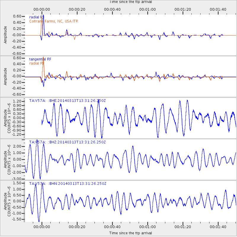
Signal To Noise
| Channel | StoN | STA | LTA |
| TA:V57A: :BHZ:20140313T13:31:26.250Z | 1.6902199 | 1.556324E-6 | 9.20782E-7 |
| TA:V57A: :BHN:20140313T13:31:26.250Z | 1.4157044 | 7.1796677E-7 | 5.071446E-7 |
| TA:V57A: :BHE:20140313T13:31:26.250Z | 1.7587991 | 9.3215493E-7 | 5.299951E-7 |
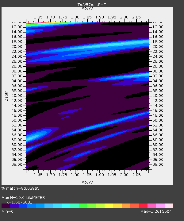
| Arrivals | |
| Ps | 1.0 SECOND |
| PpPs | 3.8 SECOND |
| PsPs/PpSs | 4.8 SECOND |

