You are here: Home > Network List > GS - US Geological Survey Networks Stations List
> Station KAN10 Keim Farm > Earthquake Result Viewer
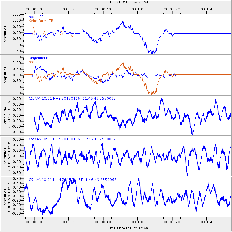
KAN10 Keim Farm - Earthquake Result Viewer
*The percent match for this event was below the threshold and hence no stack was calculated.
| Earthquake location: |
Peru-Ecuador Border Region |
| Earthquake latitude/longitude: |
-3.4/-80.1 |
| Earthquake time(UTC): |
2015/01/16 (016) 11:39:21 GMT |
| Earthquake Depth: |
68 km |
| Earthquake Magnitude: |
5.2 MW, 5.1 mb |
| Earthquake Catalog/Contributor: |
ISC/ISC |
|
| Network: |
GS US Geological Survey Networks |
| Station: |
KAN10 Keim Farm |
| Lat/Lon: |
37.12 N/98.10 W |
| Elevation: |
417 m |
|
| Distance: |
43.7 deg |
| Az: |
339.049 deg |
| Baz: |
153.476 deg |
| Ray Param: |
$rayparam |
*The percent match for this event was below the threshold and hence was not used in the summary stack. |
|
| Radial Match: |
53.492638 % |
| Radial Bump: |
400 |
| Transverse Match: |
38.179276 % |
| Transverse Bump: |
400 |
| SOD ConfigId: |
3390531 |
| Insert Time: |
2019-04-16 01:43:05.501 +0000 |
| GWidth: |
2.5 |
| Max Bumps: |
400 |
| Tol: |
0.001 |
|
Signal To Noise
| Channel | StoN | STA | LTA |
| GS:KAN10:01:HHZ:20150116T11:46:49.255006Z | 1.6419231 | 2.4540947E-7 | 1.4946467E-7 |
| GS:KAN10:01:HHN:20150116T11:46:49.255006Z | 1.3220685 | 5.380281E-7 | 4.0695932E-7 |
| GS:KAN10:01:HHE:20150116T11:46:49.255006Z | 1.6322362 | 5.010344E-7 | 3.0696194E-7 |
| Arrivals |
| Ps | |
| PpPs | |
| PsPs/PpSs | |


