You are here: Home > Network List > TA - USArray Transportable Network (new EarthScope stations) Stations List
> Station J62A Henniker, NH, USA > Earthquake Result Viewer
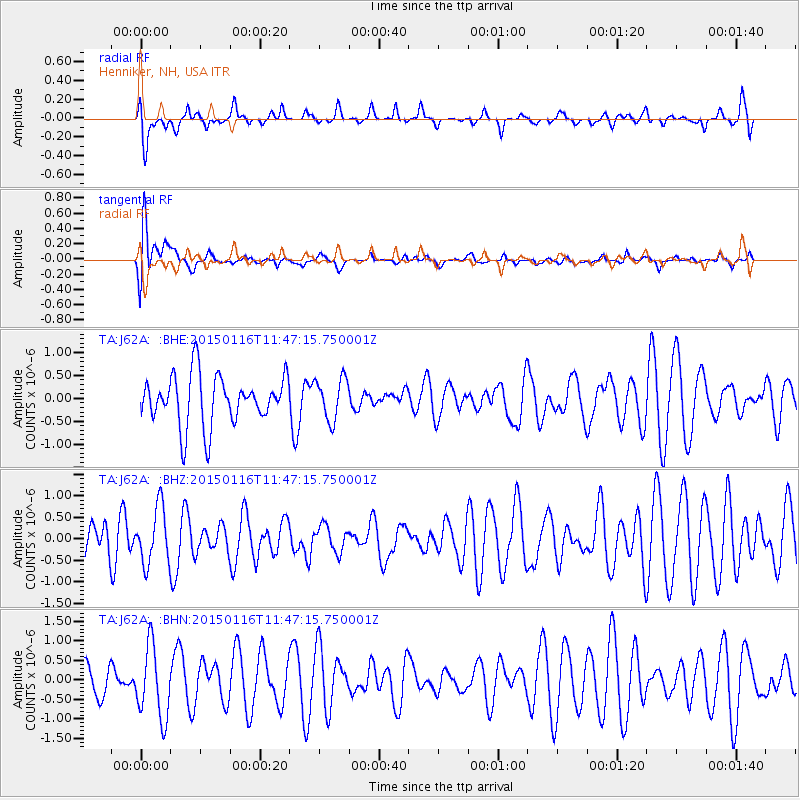
J62A Henniker, NH, USA - Earthquake Result Viewer
*The percent match for this event was below the threshold and hence no stack was calculated.
| Earthquake location: |
Peru-Ecuador Border Region |
| Earthquake latitude/longitude: |
-3.4/-80.1 |
| Earthquake time(UTC): |
2015/01/16 (016) 11:39:21 GMT |
| Earthquake Depth: |
68 km |
| Earthquake Magnitude: |
5.2 MW, 5.1 mb |
| Earthquake Catalog/Contributor: |
ISC/ISC |
|
| Network: |
TA USArray Transportable Network (new EarthScope stations) |
| Station: |
J62A Henniker, NH, USA |
| Lat/Lon: |
43.23 N/71.81 W |
| Elevation: |
266 m |
|
| Distance: |
47.0 deg |
| Az: |
8.286 deg |
| Baz: |
191.351 deg |
| Ray Param: |
$rayparam |
*The percent match for this event was below the threshold and hence was not used in the summary stack. |
|
| Radial Match: |
46.452675 % |
| Radial Bump: |
365 |
| Transverse Match: |
73.915535 % |
| Transverse Bump: |
400 |
| SOD ConfigId: |
3390531 |
| Insert Time: |
2019-04-16 01:46:54.856 +0000 |
| GWidth: |
2.5 |
| Max Bumps: |
400 |
| Tol: |
0.001 |
|
Signal To Noise
| Channel | StoN | STA | LTA |
| TA:J62A: :BHZ:20150116T11:47:15.750001Z | 1.1333528 | 6.5197577E-7 | 5.752629E-7 |
| TA:J62A: :BHN:20150116T11:47:15.750001Z | 2.6312268 | 9.1670705E-7 | 3.4839533E-7 |
| TA:J62A: :BHE:20150116T11:47:15.750001Z | 0.84061676 | 4.5407728E-7 | 5.401716E-7 |
| Arrivals |
| Ps | |
| PpPs | |
| PsPs/PpSs | |


