You are here: Home > Network List > US - United States National Seismic Network Stations List
> Station ERPA Erie, Pennsylvania, USA > Earthquake Result Viewer
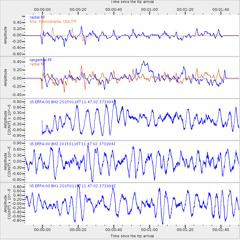
ERPA Erie, Pennsylvania, USA - Earthquake Result Viewer
*The percent match for this event was below the threshold and hence no stack was calculated.
| Earthquake location: |
Peru-Ecuador Border Region |
| Earthquake latitude/longitude: |
-3.4/-80.1 |
| Earthquake time(UTC): |
2015/01/16 (016) 11:39:21 GMT |
| Earthquake Depth: |
68 km |
| Earthquake Magnitude: |
5.2 MW, 5.1 mb |
| Earthquake Catalog/Contributor: |
ISC/ISC |
|
| Network: |
US United States National Seismic Network |
| Station: |
ERPA Erie, Pennsylvania, USA |
| Lat/Lon: |
42.12 N/79.99 W |
| Elevation: |
306 m |
|
| Distance: |
45.3 deg |
| Az: |
0.122 deg |
| Baz: |
180.163 deg |
| Ray Param: |
$rayparam |
*The percent match for this event was below the threshold and hence was not used in the summary stack. |
|
| Radial Match: |
52.306423 % |
| Radial Bump: |
400 |
| Transverse Match: |
47.85691 % |
| Transverse Bump: |
400 |
| SOD ConfigId: |
3390531 |
| Insert Time: |
2019-04-16 01:47:47.180 +0000 |
| GWidth: |
2.5 |
| Max Bumps: |
400 |
| Tol: |
0.001 |
|
Signal To Noise
| Channel | StoN | STA | LTA |
| US:ERPA:00:BHZ:20150116T11:47:02.373994Z | 0.8963661 | 2.9791627E-7 | 3.3236006E-7 |
| US:ERPA:00:BH1:20150116T11:47:02.373994Z | 0.4569845 | 1.2353595E-7 | 2.7032854E-7 |
| US:ERPA:00:BH2:20150116T11:47:02.373994Z | 1.3247008 | 5.04339E-7 | 3.8071917E-7 |
| Arrivals |
| Ps | |
| PpPs | |
| PsPs/PpSs | |


