You are here: Home > Network List > TA - USArray Transportable Network (new EarthScope stations) Stations List
> Station D49A Beulah Township, ON, CAN > Earthquake Result Viewer
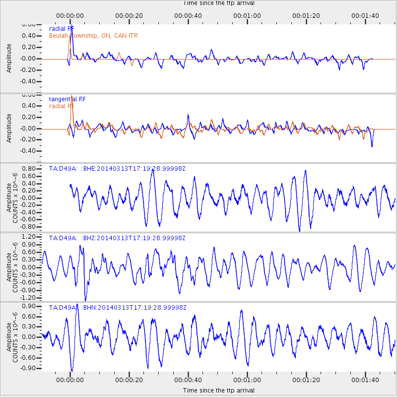
D49A Beulah Township, ON, CAN - Earthquake Result Viewer
*The percent match for this event was below the threshold and hence no stack was calculated.
| Earthquake location: |
Kyushu, Japan |
| Earthquake latitude/longitude: |
33.7/131.8 |
| Earthquake time(UTC): |
2014/03/13 (072) 17:06:50 GMT |
| Earthquake Depth: |
79 km |
| Earthquake Magnitude: |
6.3 MWW, 6.3 MWB, 6.3 MWC |
| Earthquake Catalog/Contributor: |
NEIC PDE/NEIC COMCAT |
|
| Network: |
TA USArray Transportable Network (new EarthScope stations) |
| Station: |
D49A Beulah Township, ON, CAN |
| Lat/Lon: |
47.27 N/81.36 W |
| Elevation: |
416 m |
|
| Distance: |
94.1 deg |
| Az: |
21.939 deg |
| Baz: |
332.775 deg |
| Ray Param: |
$rayparam |
*The percent match for this event was below the threshold and hence was not used in the summary stack. |
|
| Radial Match: |
65.03355 % |
| Radial Bump: |
400 |
| Transverse Match: |
51.477592 % |
| Transverse Bump: |
400 |
| SOD ConfigId: |
626651 |
| Insert Time: |
2014-04-21 04:43:47.355 +0000 |
| GWidth: |
2.5 |
| Max Bumps: |
400 |
| Tol: |
0.001 |
|
Signal To Noise
| Channel | StoN | STA | LTA |
| TA:D49A: :BHZ:20140313T17:19:28.99998Z | 1.1538547 | 4.6870548E-7 | 4.062084E-7 |
| TA:D49A: :BHN:20140313T17:19:28.99998Z | 2.2819836 | 5.815731E-7 | 2.548542E-7 |
| TA:D49A: :BHE:20140313T17:19:28.99998Z | 2.196043 | 4.2463125E-7 | 1.9336198E-7 |
| Arrivals |
| Ps | |
| PpPs | |
| PsPs/PpSs | |


