You are here: Home > Network List > TA - USArray Transportable Network (new EarthScope stations) Stations List
> Station I23K Minto, Yukon-Koyukuk, AK, USA > Earthquake Result Viewer
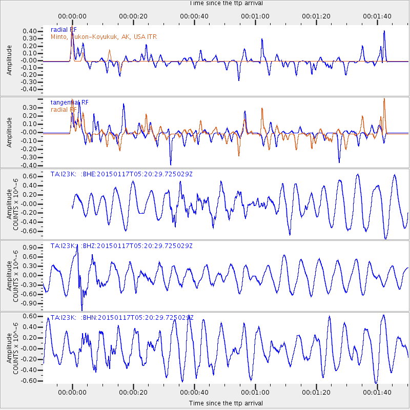
I23K Minto, Yukon-Koyukuk, AK, USA - Earthquake Result Viewer
*The percent match for this event was below the threshold and hence no stack was calculated.
| Earthquake location: |
Mindoro, Philippines |
| Earthquake latitude/longitude: |
13.9/120.6 |
| Earthquake time(UTC): |
2015/01/17 (017) 05:09:19 GMT |
| Earthquake Depth: |
135 km |
| Earthquake Magnitude: |
5.3 MW, 5.3 mb |
| Earthquake Catalog/Contributor: |
ISC/ISC |
|
| Network: |
TA USArray Transportable Network (new EarthScope stations) |
| Station: |
I23K Minto, Yukon-Koyukuk, AK, USA |
| Lat/Lon: |
65.15 N/149.36 W |
| Elevation: |
149 m |
|
| Distance: |
77.5 deg |
| Az: |
25.645 deg |
| Baz: |
275.963 deg |
| Ray Param: |
$rayparam |
*The percent match for this event was below the threshold and hence was not used in the summary stack. |
|
| Radial Match: |
68.47929 % |
| Radial Bump: |
400 |
| Transverse Match: |
65.958115 % |
| Transverse Bump: |
400 |
| SOD ConfigId: |
3390531 |
| Insert Time: |
2019-04-16 01:53:01.224 +0000 |
| GWidth: |
2.5 |
| Max Bumps: |
400 |
| Tol: |
0.001 |
|
Signal To Noise
| Channel | StoN | STA | LTA |
| TA:I23K: :BHZ:20150117T05:20:29.725029Z | 1.5975542 | 5.8117797E-7 | 3.6379234E-7 |
| TA:I23K: :BHN:20150117T05:20:29.725029Z | 0.44587407 | 1.679961E-7 | 3.7677927E-7 |
| TA:I23K: :BHE:20150117T05:20:29.725029Z | 0.97687507 | 2.3890715E-7 | 2.4456264E-7 |
| Arrivals |
| Ps | |
| PpPs | |
| PsPs/PpSs | |


