You are here: Home > Network List > TA - USArray Transportable Network (new EarthScope stations) Stations List
> Station L53A Girard, PA, USA > Earthquake Result Viewer
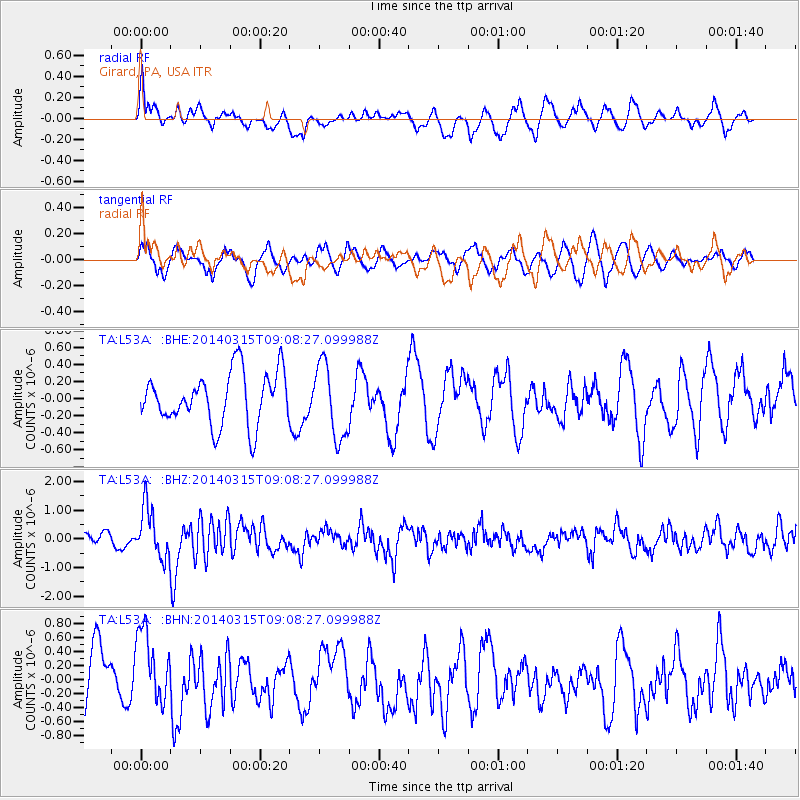
L53A Girard, PA, USA - Earthquake Result Viewer
*The percent match for this event was below the threshold and hence no stack was calculated.
| Earthquake location: |
Near Coast Of Peru |
| Earthquake latitude/longitude: |
-14.1/-76.3 |
| Earthquake time(UTC): |
2014/03/15 (074) 08:59:21 GMT |
| Earthquake Depth: |
20 km |
| Earthquake Magnitude: |
6.1 MWW, 6.0 MWB, 6.2 MWC |
| Earthquake Catalog/Contributor: |
NEIC PDE/NEIC COMCAT |
|
| Network: |
TA USArray Transportable Network (new EarthScope stations) |
| Station: |
L53A Girard, PA, USA |
| Lat/Lon: |
41.95 N/80.26 W |
| Elevation: |
355 m |
|
| Distance: |
55.9 deg |
| Az: |
356.441 deg |
| Baz: |
175.368 deg |
| Ray Param: |
$rayparam |
*The percent match for this event was below the threshold and hence was not used in the summary stack. |
|
| Radial Match: |
67.46035 % |
| Radial Bump: |
400 |
| Transverse Match: |
64.63951 % |
| Transverse Bump: |
400 |
| SOD ConfigId: |
626651 |
| Insert Time: |
2014-04-21 05:25:29.616 +0000 |
| GWidth: |
2.5 |
| Max Bumps: |
400 |
| Tol: |
0.001 |
|
Signal To Noise
| Channel | StoN | STA | LTA |
| TA:L53A: :BHZ:20140315T09:08:27.099988Z | 3.3024108 | 8.694949E-7 | 2.6329096E-7 |
| TA:L53A: :BHN:20140315T09:08:27.099988Z | 1.551224 | 5.5481985E-7 | 3.576658E-7 |
| TA:L53A: :BHE:20140315T09:08:27.099988Z | 1.4330348 | 4.345653E-7 | 3.0324827E-7 |
| Arrivals |
| Ps | |
| PpPs | |
| PsPs/PpSs | |


