You are here: Home > Network List > TA - USArray Transportable Network (new EarthScope stations) Stations List
> Station L59A Walton, NY, USA > Earthquake Result Viewer
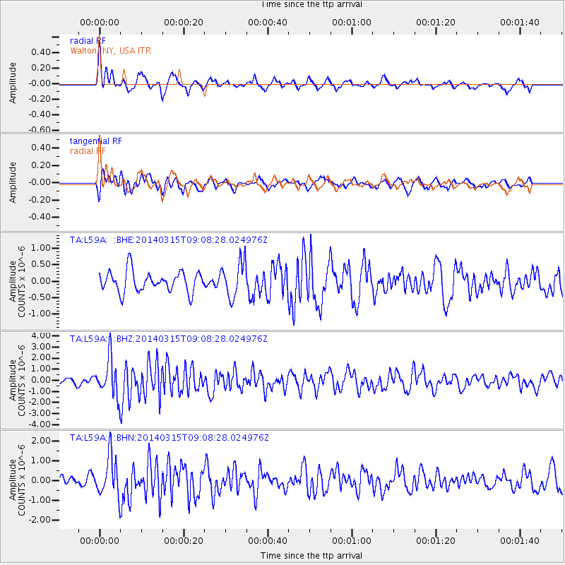
L59A Walton, NY, USA - Earthquake Result Viewer
*The percent match for this event was below the threshold and hence no stack was calculated.
| Earthquake location: |
Near Coast Of Peru |
| Earthquake latitude/longitude: |
-14.1/-76.3 |
| Earthquake time(UTC): |
2014/03/15 (074) 08:59:21 GMT |
| Earthquake Depth: |
20 km |
| Earthquake Magnitude: |
6.1 MWW, 6.0 MWB, 6.2 MWC |
| Earthquake Catalog/Contributor: |
NEIC PDE/NEIC COMCAT |
|
| Network: |
TA USArray Transportable Network (new EarthScope stations) |
| Station: |
L59A Walton, NY, USA |
| Lat/Lon: |
42.19 N/75.04 W |
| Elevation: |
677 m |
|
| Distance: |
56.0 deg |
| Az: |
1.135 deg |
| Baz: |
181.482 deg |
| Ray Param: |
$rayparam |
*The percent match for this event was below the threshold and hence was not used in the summary stack. |
|
| Radial Match: |
67.0927 % |
| Radial Bump: |
367 |
| Transverse Match: |
57.75209 % |
| Transverse Bump: |
400 |
| SOD ConfigId: |
626651 |
| Insert Time: |
2014-04-21 05:25:45.612 +0000 |
| GWidth: |
2.5 |
| Max Bumps: |
400 |
| Tol: |
0.001 |
|
Signal To Noise
| Channel | StoN | STA | LTA |
| TA:L59A: :BHZ:20140315T09:08:28.024976Z | 5.675697 | 1.7549454E-6 | 3.092035E-7 |
| TA:L59A: :BHN:20140315T09:08:28.024976Z | 3.1861258 | 1.0380554E-6 | 3.258049E-7 |
| TA:L59A: :BHE:20140315T09:08:28.024976Z | 1.7679098 | 5.52553E-7 | 3.1254592E-7 |
| Arrivals |
| Ps | |
| PpPs | |
| PsPs/PpSs | |


