You are here: Home > Network List > TA - USArray Transportable Network (new EarthScope stations) Stations List
> Station MDND Maddock, ND, USA > Earthquake Result Viewer
MDND Maddock, ND, USA - Earthquake Result Viewer
*The percent match for this event was below the threshold and hence no stack was calculated.
| Earthquake location: |
Near Coast Of Peru |
| Earthquake latitude/longitude: |
-14.1/-76.3 |
| Earthquake time(UTC): |
2014/03/15 (074) 08:59:21 GMT |
| Earthquake Depth: |
20 km |
| Earthquake Magnitude: |
6.1 MWW, 6.0 MWB, 6.2 MWC |
| Earthquake Catalog/Contributor: |
NEIC PDE/NEIC COMCAT |
|
| Network: |
TA USArray Transportable Network (new EarthScope stations) |
| Station: |
MDND Maddock, ND, USA |
| Lat/Lon: |
47.85 N/99.60 W |
| Elevation: |
479 m |
|
| Distance: |
65.1 deg |
| Az: |
342.919 deg |
| Baz: |
154.97 deg |
| Ray Param: |
$rayparam |
*The percent match for this event was below the threshold and hence was not used in the summary stack. |
|
| Radial Match: |
64.971954 % |
| Radial Bump: |
400 |
| Transverse Match: |
71.9375 % |
| Transverse Bump: |
400 |
| SOD ConfigId: |
626651 |
| Insert Time: |
2014-04-21 05:26:50.688 +0000 |
| GWidth: |
2.5 |
| Max Bumps: |
400 |
| Tol: |
0.001 |
|
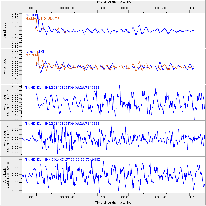
Signal To Noise
| Channel | StoN | STA | LTA |
| TA:MDND: :BHZ:20140315T09:09:29.724988Z | 3.9408026 | 1.1145644E-6 | 2.8282673E-7 |
| TA:MDND: :BHN:20140315T09:09:29.724988Z | 1.3042071 | 7.957402E-7 | 6.101333E-7 |
| TA:MDND: :BHE:20140315T09:09:29.724988Z | 1.1955389 | 7.240675E-7 | 6.056411E-7 |
| Arrivals |
| Ps | |
| PpPs | |
| PsPs/PpSs | |


