You are here: Home > Network List > TA - USArray Transportable Network (new EarthScope stations) Stations List
> Station Q58A Fox Den Farm, The Plains, VA, USA > Earthquake Result Viewer
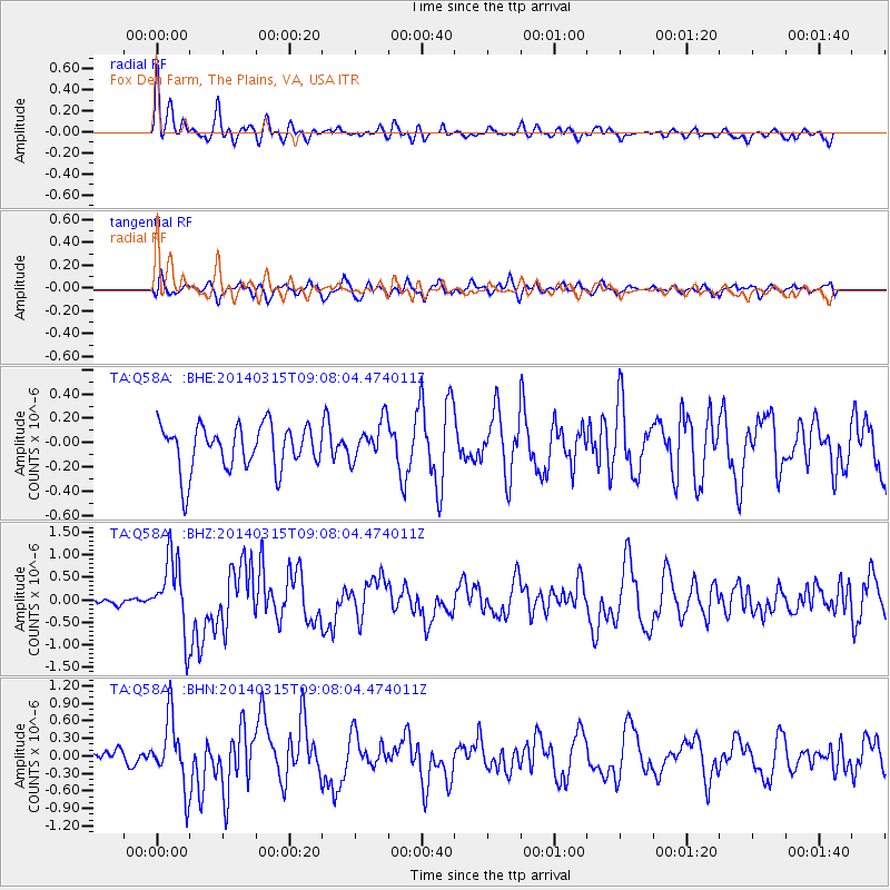
Q58A Fox Den Farm, The Plains, VA, USA - Earthquake Result Viewer
*The percent match for this event was below the threshold and hence no stack was calculated.
| Earthquake location: |
Near Coast Of Peru |
| Earthquake latitude/longitude: |
-14.1/-76.3 |
| Earthquake time(UTC): |
2014/03/15 (074) 08:59:21 GMT |
| Earthquake Depth: |
20 km |
| Earthquake Magnitude: |
6.1 MWW, 6.0 MWB, 6.2 MWC |
| Earthquake Catalog/Contributor: |
NEIC PDE/NEIC COMCAT |
|
| Network: |
TA USArray Transportable Network (new EarthScope stations) |
| Station: |
Q58A Fox Den Farm, The Plains, VA, USA |
| Lat/Lon: |
38.94 N/77.68 W |
| Elevation: |
182 m |
|
| Distance: |
52.8 deg |
| Az: |
358.655 deg |
| Baz: |
178.327 deg |
| Ray Param: |
$rayparam |
*The percent match for this event was below the threshold and hence was not used in the summary stack. |
|
| Radial Match: |
67.89749 % |
| Radial Bump: |
372 |
| Transverse Match: |
47.87749 % |
| Transverse Bump: |
400 |
| SOD ConfigId: |
626651 |
| Insert Time: |
2014-04-21 05:29:17.602 +0000 |
| GWidth: |
2.5 |
| Max Bumps: |
400 |
| Tol: |
0.001 |
|
Signal To Noise
| Channel | StoN | STA | LTA |
| TA:Q58A: :BHZ:20140315T09:08:04.474011Z | 3.545937 | 8.174581E-7 | 2.3053374E-7 |
| TA:Q58A: :BHN:20140315T09:08:04.474011Z | 2.6336026 | 5.8058043E-7 | 2.2045104E-7 |
| TA:Q58A: :BHE:20140315T09:08:04.474011Z | 0.8766429 | 1.6175099E-7 | 1.8451183E-7 |
| Arrivals |
| Ps | |
| PpPs | |
| PsPs/PpSs | |


