You are here: Home > Network List > TA - USArray Transportable Network (new EarthScope stations) Stations List
> Station R60A Leonardtown, MD, USA > Earthquake Result Viewer
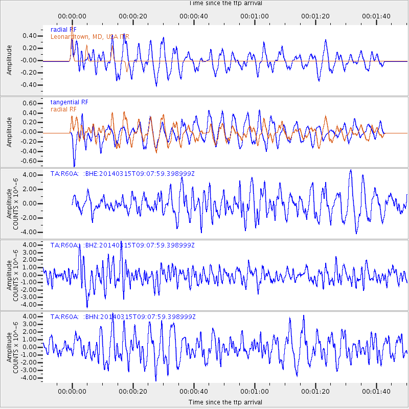
R60A Leonardtown, MD, USA - Earthquake Result Viewer
*The percent match for this event was below the threshold and hence no stack was calculated.
| Earthquake location: |
Near Coast Of Peru |
| Earthquake latitude/longitude: |
-14.1/-76.3 |
| Earthquake time(UTC): |
2014/03/15 (074) 08:59:21 GMT |
| Earthquake Depth: |
20 km |
| Earthquake Magnitude: |
6.1 MWW, 6.0 MWB, 6.2 MWC |
| Earthquake Catalog/Contributor: |
NEIC PDE/NEIC COMCAT |
|
| Network: |
TA USArray Transportable Network (new EarthScope stations) |
| Station: |
R60A Leonardtown, MD, USA |
| Lat/Lon: |
38.26 N/76.58 W |
| Elevation: |
33 m |
|
| Distance: |
52.1 deg |
| Az: |
359.729 deg |
| Baz: |
179.666 deg |
| Ray Param: |
$rayparam |
*The percent match for this event was below the threshold and hence was not used in the summary stack. |
|
| Radial Match: |
62.799995 % |
| Radial Bump: |
400 |
| Transverse Match: |
76.70839 % |
| Transverse Bump: |
400 |
| SOD ConfigId: |
626651 |
| Insert Time: |
2014-04-21 05:29:56.803 +0000 |
| GWidth: |
2.5 |
| Max Bumps: |
400 |
| Tol: |
0.001 |
|
Signal To Noise
| Channel | StoN | STA | LTA |
| TA:R60A: :BHZ:20140315T09:07:59.398999Z | 2.5516796 | 1.7960137E-6 | 7.038555E-7 |
| TA:R60A: :BHN:20140315T09:07:59.398999Z | 1.0612062 | 1.0142121E-6 | 9.557164E-7 |
| TA:R60A: :BHE:20140315T09:07:59.398999Z | 1.8503572 | 1.6065968E-6 | 8.682631E-7 |
| Arrivals |
| Ps | |
| PpPs | |
| PsPs/PpSs | |


