You are here: Home > Network List > TA - USArray Transportable Network (new EarthScope stations) Stations List
> Station X43A Marvell, AR, USA > Earthquake Result Viewer
X43A Marvell, AR, USA - Earthquake Result Viewer
*The percent match for this event was below the threshold and hence no stack was calculated.
| Earthquake location: |
Near Coast Of Peru |
| Earthquake latitude/longitude: |
-14.1/-76.3 |
| Earthquake time(UTC): |
2014/03/15 (074) 08:59:21 GMT |
| Earthquake Depth: |
20 km |
| Earthquake Magnitude: |
6.1 MWW, 6.0 MWB, 6.2 MWC |
| Earthquake Catalog/Contributor: |
NEIC PDE/NEIC COMCAT |
|
| Network: |
TA USArray Transportable Network (new EarthScope stations) |
| Station: |
X43A Marvell, AR, USA |
| Lat/Lon: |
34.52 N/90.88 W |
| Elevation: |
53 m |
|
| Distance: |
50.3 deg |
| Az: |
344.333 deg |
| Baz: |
161.498 deg |
| Ray Param: |
$rayparam |
*The percent match for this event was below the threshold and hence was not used in the summary stack. |
|
| Radial Match: |
45.959534 % |
| Radial Bump: |
324 |
| Transverse Match: |
52.29696 % |
| Transverse Bump: |
323 |
| SOD ConfigId: |
626651 |
| Insert Time: |
2014-04-21 05:32:27.136 +0000 |
| GWidth: |
2.5 |
| Max Bumps: |
400 |
| Tol: |
0.001 |
|
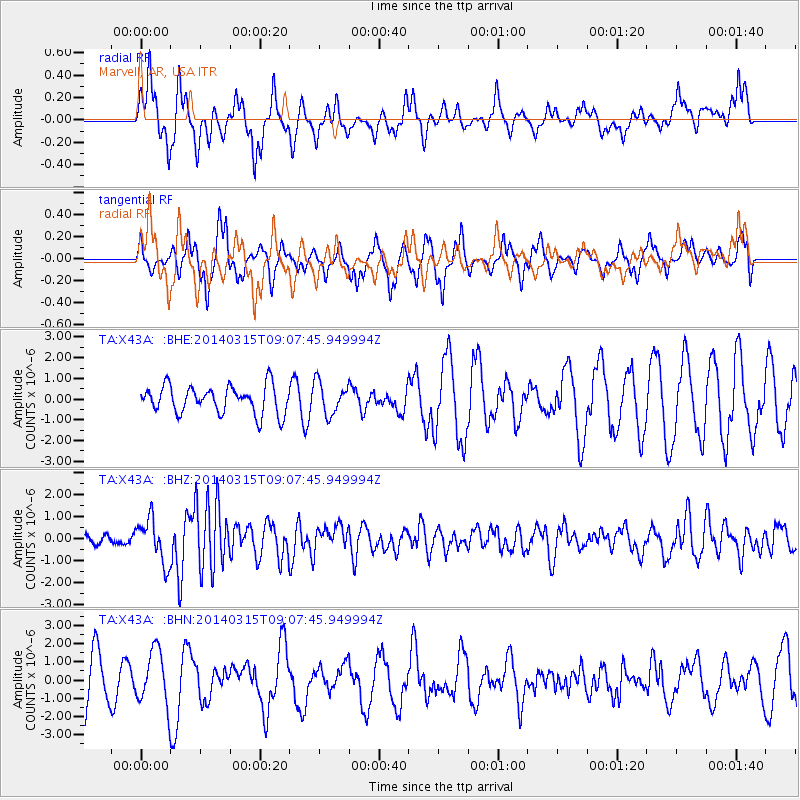
Signal To Noise
| Channel | StoN | STA | LTA |
| TA:X43A: :BHZ:20140315T09:07:45.949994Z | 4.631725 | 9.963586E-7 | 2.151161E-7 |
| TA:X43A: :BHN:20140315T09:07:45.949994Z | 0.9264268 | 1.5097568E-6 | 1.6296557E-6 |
| TA:X43A: :BHE:20140315T09:07:45.949994Z | 1.159583 | 7.7571457E-7 | 6.6895996E-7 |
| Arrivals |
| Ps | |
| PpPs | |
| PsPs/PpSs | |


