You are here: Home > Network List > US - United States National Seismic Network Stations List
> Station HDIL Hopedale, Illinois, USA > Earthquake Result Viewer
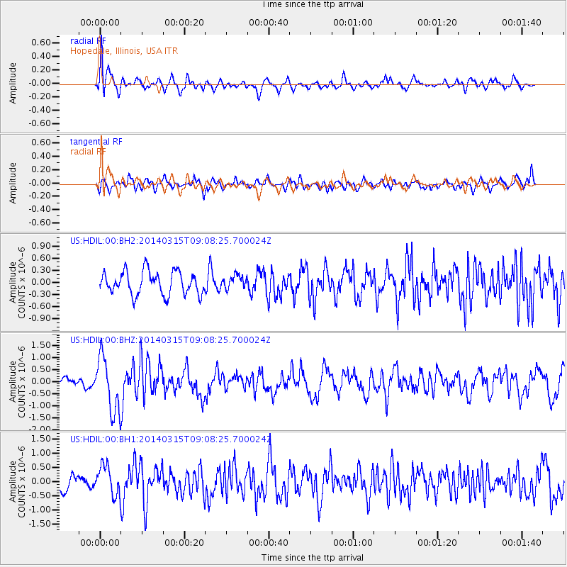
HDIL Hopedale, Illinois, USA - Earthquake Result Viewer
*The percent match for this event was below the threshold and hence no stack was calculated.
| Earthquake location: |
Near Coast Of Peru |
| Earthquake latitude/longitude: |
-14.1/-76.3 |
| Earthquake time(UTC): |
2014/03/15 (074) 08:59:21 GMT |
| Earthquake Depth: |
20 km |
| Earthquake Magnitude: |
6.1 MWW, 6.0 MWB, 6.2 MWC |
| Earthquake Catalog/Contributor: |
NEIC PDE/NEIC COMCAT |
|
| Network: |
US United States National Seismic Network |
| Station: |
HDIL Hopedale, Illinois, USA |
| Lat/Lon: |
40.56 N/89.29 W |
| Elevation: |
219 m |
|
| Distance: |
55.7 deg |
| Az: |
348.038 deg |
| Baz: |
164.696 deg |
| Ray Param: |
$rayparam |
*The percent match for this event was below the threshold and hence was not used in the summary stack. |
|
| Radial Match: |
64.85447 % |
| Radial Bump: |
400 |
| Transverse Match: |
49.10523 % |
| Transverse Bump: |
400 |
| SOD ConfigId: |
626651 |
| Insert Time: |
2014-04-21 05:34:21.015 +0000 |
| GWidth: |
2.5 |
| Max Bumps: |
400 |
| Tol: |
0.001 |
|
Signal To Noise
| Channel | StoN | STA | LTA |
| US:HDIL:00:BHZ:20140315T09:08:25.700024Z | 5.4051065 | 1.1677201E-6 | 2.1604016E-7 |
| US:HDIL:00:BH1:20140315T09:08:25.700024Z | 1.3963232 | 5.374943E-7 | 3.8493548E-7 |
| US:HDIL:00:BH2:20140315T09:08:25.700024Z | 0.5893377 | 1.6674504E-7 | 2.8293633E-7 |
| Arrivals |
| Ps | |
| PpPs | |
| PsPs/PpSs | |


