You are here: Home > Network List > US - United States National Seismic Network Stations List
> Station WMOK Wichita Mountains, Oklahoma, USA > Earthquake Result Viewer
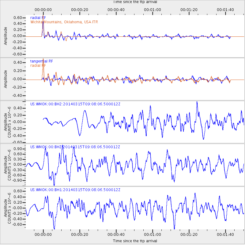
WMOK Wichita Mountains, Oklahoma, USA - Earthquake Result Viewer
*The percent match for this event was below the threshold and hence no stack was calculated.
| Earthquake location: |
Near Coast Of Peru |
| Earthquake latitude/longitude: |
-14.1/-76.3 |
| Earthquake time(UTC): |
2014/03/15 (074) 08:59:21 GMT |
| Earthquake Depth: |
20 km |
| Earthquake Magnitude: |
6.1 MWW, 6.0 MWB, 6.2 MWC |
| Earthquake Catalog/Contributor: |
NEIC PDE/NEIC COMCAT |
|
| Network: |
US United States National Seismic Network |
| Station: |
WMOK Wichita Mountains, Oklahoma, USA |
| Lat/Lon: |
34.74 N/98.78 W |
| Elevation: |
486 m |
|
| Distance: |
53.1 deg |
| Az: |
336.803 deg |
| Baz: |
152.35 deg |
| Ray Param: |
$rayparam |
*The percent match for this event was below the threshold and hence was not used in the summary stack. |
|
| Radial Match: |
58.241146 % |
| Radial Bump: |
367 |
| Transverse Match: |
50.250076 % |
| Transverse Bump: |
400 |
| SOD ConfigId: |
626651 |
| Insert Time: |
2014-04-21 05:35:20.249 +0000 |
| GWidth: |
2.5 |
| Max Bumps: |
400 |
| Tol: |
0.001 |
|
Signal To Noise
| Channel | StoN | STA | LTA |
| US:WMOK:00:BHZ:20140315T09:08:06.500012Z | 2.9787471 | 5.929422E-7 | 1.9905757E-7 |
| US:WMOK:00:BH1:20140315T09:08:06.500012Z | 1.3135109 | 2.3755662E-7 | 1.8085622E-7 |
| US:WMOK:00:BH2:20140315T09:08:06.500012Z | 0.8147426 | 1.1195588E-7 | 1.3741257E-7 |
| Arrivals |
| Ps | |
| PpPs | |
| PsPs/PpSs | |


