You are here: Home > Network List > WY - Yellowstone Wyoming Seismic Network Stations List
> Station YUF Upper Falls, WY, USA > Earthquake Result Viewer
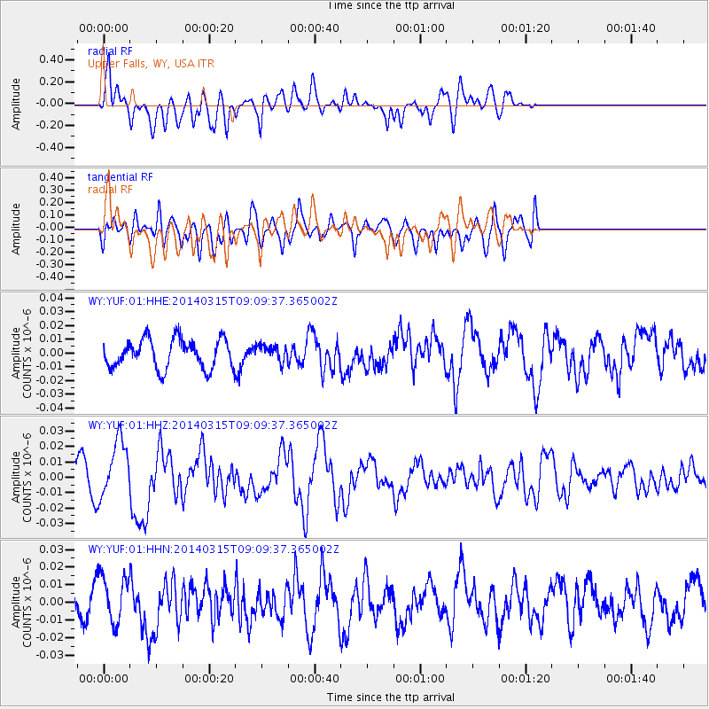
YUF Upper Falls, WY, USA - Earthquake Result Viewer
*The percent match for this event was below the threshold and hence no stack was calculated.
| Earthquake location: |
Near Coast Of Peru |
| Earthquake latitude/longitude: |
-14.1/-76.3 |
| Earthquake time(UTC): |
2014/03/15 (074) 08:59:21 GMT |
| Earthquake Depth: |
20 km |
| Earthquake Magnitude: |
6.1 MWW, 6.0 MWB, 6.2 MWC |
| Earthquake Catalog/Contributor: |
NEIC PDE/NEIC COMCAT |
|
| Network: |
WY Yellowstone Wyoming Seismic Network |
| Station: |
YUF Upper Falls, WY, USA |
| Lat/Lon: |
44.71 N/110.51 W |
| Elevation: |
2394 m |
|
| Distance: |
66.3 deg |
| Az: |
334.035 deg |
| Baz: |
143.43 deg |
| Ray Param: |
$rayparam |
*The percent match for this event was below the threshold and hence was not used in the summary stack. |
|
| Radial Match: |
56.65292 % |
| Radial Bump: |
400 |
| Transverse Match: |
50.54244 % |
| Transverse Bump: |
400 |
| SOD ConfigId: |
626651 |
| Insert Time: |
2014-04-21 05:38:18.555 +0000 |
| GWidth: |
2.5 |
| Max Bumps: |
400 |
| Tol: |
0.001 |
|
Signal To Noise
| Channel | StoN | STA | LTA |
| WY:YUF:01:HHZ:20140315T09:09:37.365002Z | 2.0287929 | 1.9124593E-8 | 9.4265875E-9 |
| WY:YUF:01:HHN:20140315T09:09:37.365002Z | 1.2635465 | 1.3542655E-8 | 1.0717971E-8 |
| WY:YUF:01:HHE:20140315T09:09:37.365002Z | 0.55825305 | 5.85801E-9 | 1.0493467E-8 |
| Arrivals |
| Ps | |
| PpPs | |
| PsPs/PpSs | |


