
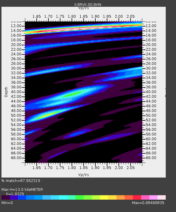
BRVK Borovoye, Kazakhstan - Earthquake Result Viewer
| ||||||||||||||||||
| ||||||||||||||||||
| ||||||||||||||||||
|
Signal To Noise
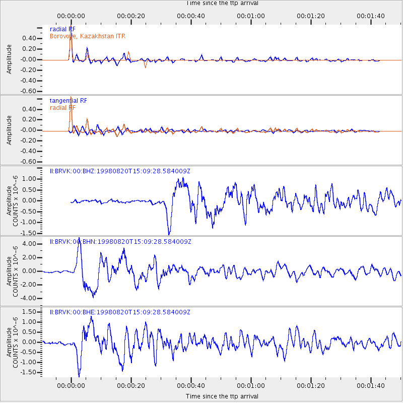
| Channel | StoN | STA | LTA |
| II:BRVK:00:BHN:19980820T15:09:28.584009Z | 28.381834 | 2.1493222E-6 | 7.57288E-8 |
| II:BRVK:00:BHE:19980820T15:09:28.584009Z | 16.54904 | 6.911237E-7 | 4.176216E-8 |
| II:BRVK:00:BHZ:19980820T15:09:28.584009Z | 15.561354 | 6.590745E-7 | 4.235329E-8 |
| Arrivals | |
| Ps | 1.7 SECOND |
| PpPs | 5.4 SECOND |
| PsPs/PpSs | 7.1 SECOND |

