You are here: Home > Network List > TA - USArray Transportable Network (new EarthScope stations) Stations List
> Station R53A Hurricane, WV, USA > Earthquake Result Viewer
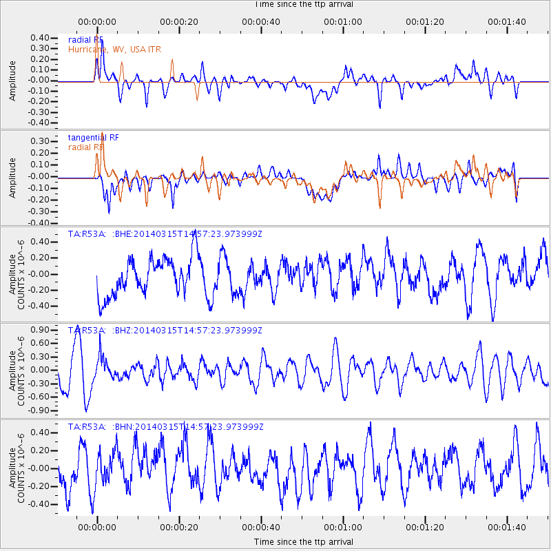
R53A Hurricane, WV, USA - Earthquake Result Viewer
*The percent match for this event was below the threshold and hence no stack was calculated.
| Earthquake location: |
Near Coast Of Central Chile |
| Earthquake latitude/longitude: |
-34.7/-71.8 |
| Earthquake time(UTC): |
2014/03/15 (074) 14:46:28 GMT |
| Earthquake Depth: |
45 km |
| Earthquake Magnitude: |
5.5 MB, 5.1 MWW |
| Earthquake Catalog/Contributor: |
NEIC PDE/NEIC COMCAT |
|
| Network: |
TA USArray Transportable Network (new EarthScope stations) |
| Station: |
R53A Hurricane, WV, USA |
| Lat/Lon: |
38.33 N/81.95 W |
| Elevation: |
294 m |
|
| Distance: |
73.3 deg |
| Az: |
351.667 deg |
| Baz: |
171.271 deg |
| Ray Param: |
$rayparam |
*The percent match for this event was below the threshold and hence was not used in the summary stack. |
|
| Radial Match: |
66.19899 % |
| Radial Bump: |
400 |
| Transverse Match: |
48.57836 % |
| Transverse Bump: |
400 |
| SOD ConfigId: |
626651 |
| Insert Time: |
2014-04-21 06:05:39.572 +0000 |
| GWidth: |
2.5 |
| Max Bumps: |
400 |
| Tol: |
0.001 |
|
Signal To Noise
| Channel | StoN | STA | LTA |
| TA:R53A: :BHZ:20140315T14:57:23.973999Z | 0.9190979 | 2.5847467E-7 | 2.8122648E-7 |
| TA:R53A: :BHN:20140315T14:57:23.973999Z | 1.0363193 | 2.1358038E-7 | 2.0609515E-7 |
| TA:R53A: :BHE:20140315T14:57:23.973999Z | 0.98775274 | 2.2797116E-7 | 2.307978E-7 |
| Arrivals |
| Ps | |
| PpPs | |
| PsPs/PpSs | |


