PLCA Paso Flores, Argentina - Earthquake Result Viewer
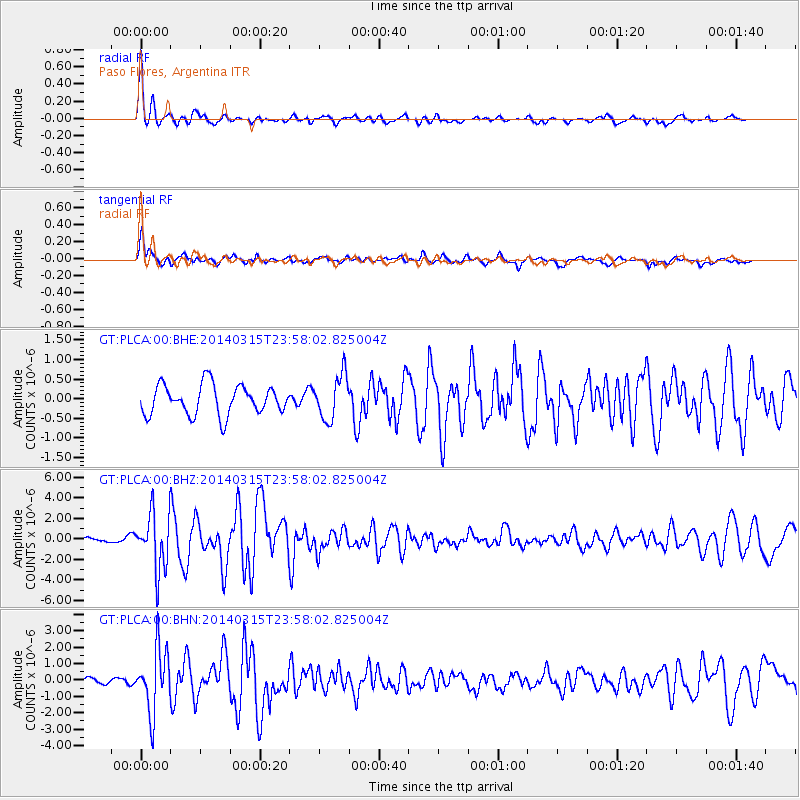
Earthquake location: Near Coast Of Northern Peru
Earthquake latitude/longitude: -5.6/-81.0
Earthquake time(UTC): 2014/03/15 (074) 23:51:33 GMT
Earthquake Depth: 29 km
Earthquake Magnitude: 6.3 MWW, 6.2 MWB, 6.3 MWC
Earthquake Catalog/Contributor: NEIC PDE/NEIC COMCAT
Network: GT Global Telemetered Seismograph Network (USAF/USGS)
Station: PLCA Paso Flores, Argentina
Lat/Lon: 40.73 S/70.55 W
Elevation: 1050 m
Distance: 36.2 deg
Az: 166.57 deg
Baz: 342.289 deg
Ray Param: 0.07674721
Estimated Moho Depth: 10.25 km
Estimated Crust Vp/Vs: 2.10
Assumed Crust Vp: 6.597 km/s
Estimated Crust Vs: 3.145 km/s
Estimated Crust Poisson's Ratio: 0.35
Radial Match: 86.650986 %
Radial Bump: 384
Transverse Match: 80.240074 %
Transverse Bump: 400
SOD ConfigId: 626651
Insert Time: 2014-04-21 06:25:05.043 +0000
GWidth: 2.5
Max Bumps: 400
Tol: 0.001

Signal To Noise

ChannelStoNSTALTA
GT:PLCA:00:BHZ:20140315T23:58:02.825004Z8.4895182.7210644E-63.2052048E-7
GT:PLCA:00:BHN:20140315T23:58:02.825004Z7.88970571.9152506E-62.427531E-7
GT:PLCA:00:BHE:20140315T23:58:02.825004Z1.4904545.658581E-73.7965486E-7
Arrivals
Ps1.8 SECOND
PpPs4.5 SECOND
PsPs/PpSs6.3 SECOND