You are here: Home > Network List > US - United States National Seismic Network Stations List
> Station BRAL Brewton, Alabama, USA > Earthquake Result Viewer
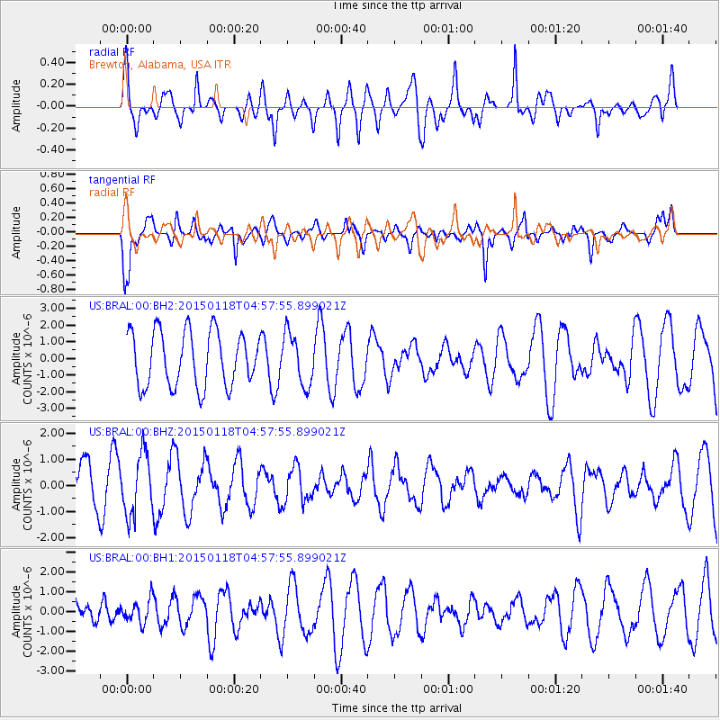
BRAL Brewton, Alabama, USA - Earthquake Result Viewer
*The percent match for this event was below the threshold and hence no stack was calculated.
| Earthquake location: |
Rat Islands, Aleutian Islands |
| Earthquake latitude/longitude: |
51.9/179.6 |
| Earthquake time(UTC): |
2015/01/18 (018) 04:47:38 GMT |
| Earthquake Depth: |
106 km |
| Earthquake Magnitude: |
5.8 MB, 5.9 MB |
| Earthquake Catalog/Contributor: |
NEIC PDE/NEIC COMCAT |
|
| Network: |
US United States National Seismic Network |
| Station: |
BRAL Brewton, Alabama, USA |
| Lat/Lon: |
31.17 N/87.05 W |
| Elevation: |
61 m |
|
| Distance: |
68.1 deg |
| Az: |
67.253 deg |
| Baz: |
318.199 deg |
| Ray Param: |
$rayparam |
*The percent match for this event was below the threshold and hence was not used in the summary stack. |
|
| Radial Match: |
63.35178 % |
| Radial Bump: |
400 |
| Transverse Match: |
70.26233 % |
| Transverse Bump: |
377 |
| SOD ConfigId: |
3390531 |
| Insert Time: |
2019-04-16 02:28:26.199 +0000 |
| GWidth: |
2.5 |
| Max Bumps: |
400 |
| Tol: |
0.001 |
|
Signal To Noise
| Channel | StoN | STA | LTA |
| US:BRAL:00:BHZ:20150118T04:57:55.899021Z | 1.8040425 | 1.175148E-6 | 6.5139704E-7 |
| US:BRAL:00:BH1:20150118T04:57:55.899021Z | 0.6574213 | 5.954518E-7 | 9.0573855E-7 |
| US:BRAL:00:BH2:20150118T04:57:55.899021Z | 0.940113 | 1.5455166E-6 | 1.643969E-6 |
| Arrivals |
| Ps | |
| PpPs | |
| PsPs/PpSs | |


