You are here: Home > Network List > TA - USArray Transportable Network (new EarthScope stations) Stations List
> Station L04D Klamath Falls, OR, USA > Earthquake Result Viewer
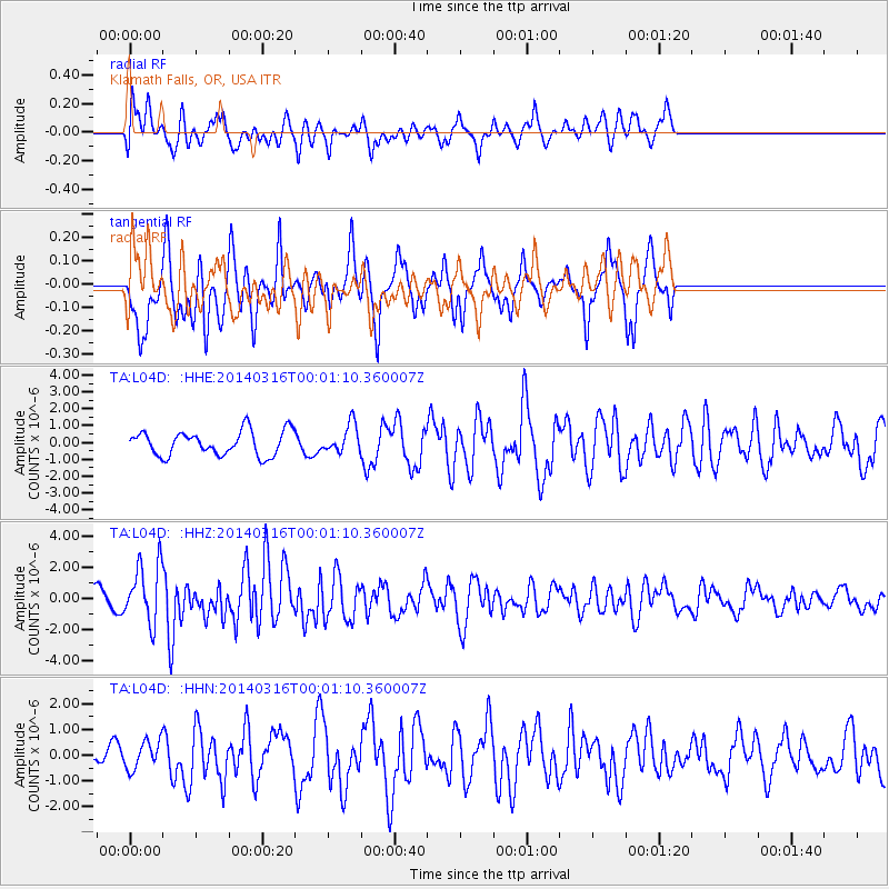
L04D Klamath Falls, OR, USA - Earthquake Result Viewer
*The percent match for this event was below the threshold and hence no stack was calculated.
| Earthquake location: |
Near Coast Of Northern Peru |
| Earthquake latitude/longitude: |
-5.6/-81.0 |
| Earthquake time(UTC): |
2014/03/15 (074) 23:51:33 GMT |
| Earthquake Depth: |
29 km |
| Earthquake Magnitude: |
6.3 MWW, 6.2 MWB, 6.3 MWC |
| Earthquake Catalog/Contributor: |
NEIC PDE/NEIC COMCAT |
|
| Network: |
TA USArray Transportable Network (new EarthScope stations) |
| Station: |
L04D Klamath Falls, OR, USA |
| Lat/Lon: |
42.22 N/122.30 W |
| Elevation: |
1437 m |
|
| Distance: |
60.6 deg |
| Az: |
325.73 deg |
| Baz: |
131.019 deg |
| Ray Param: |
$rayparam |
*The percent match for this event was below the threshold and hence was not used in the summary stack. |
|
| Radial Match: |
56.81213 % |
| Radial Bump: |
400 |
| Transverse Match: |
67.60474 % |
| Transverse Bump: |
363 |
| SOD ConfigId: |
626651 |
| Insert Time: |
2014-04-21 06:48:11.008 +0000 |
| GWidth: |
2.5 |
| Max Bumps: |
400 |
| Tol: |
0.001 |
|
Signal To Noise
| Channel | StoN | STA | LTA |
| TA:L04D: :HHZ:20140316T00:01:10.360007Z | 3.1055243 | 1.8972418E-6 | 6.109248E-7 |
| TA:L04D: :HHN:20140316T00:01:10.360007Z | 1.3041952 | 5.360983E-7 | 4.110568E-7 |
| TA:L04D: :HHE:20140316T00:01:10.360007Z | 1.138846 | 8.2805815E-7 | 7.2710276E-7 |
| Arrivals |
| Ps | |
| PpPs | |
| PsPs/PpSs | |


