You are here: Home > Network List > TA - USArray Transportable Network (new EarthScope stations) Stations List
> Station R59A King George, VA, USA > Earthquake Result Viewer
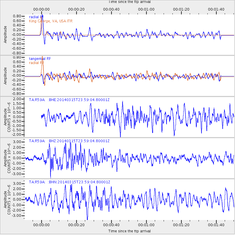
R59A King George, VA, USA - Earthquake Result Viewer
*The percent match for this event was below the threshold and hence no stack was calculated.
| Earthquake location: |
Near Coast Of Northern Peru |
| Earthquake latitude/longitude: |
-5.6/-81.0 |
| Earthquake time(UTC): |
2014/03/15 (074) 23:51:33 GMT |
| Earthquake Depth: |
29 km |
| Earthquake Magnitude: |
6.3 MWW, 6.2 MWB, 6.3 MWC |
| Earthquake Catalog/Contributor: |
NEIC PDE/NEIC COMCAT |
|
| Network: |
TA USArray Transportable Network (new EarthScope stations) |
| Station: |
R59A King George, VA, USA |
| Lat/Lon: |
38.20 N/77.12 W |
| Elevation: |
35 m |
|
| Distance: |
43.7 deg |
| Az: |
4.38 deg |
| Baz: |
185.537 deg |
| Ray Param: |
$rayparam |
*The percent match for this event was below the threshold and hence was not used in the summary stack. |
|
| Radial Match: |
78.08663 % |
| Radial Bump: |
400 |
| Transverse Match: |
61.766514 % |
| Transverse Bump: |
400 |
| SOD ConfigId: |
626651 |
| Insert Time: |
2014-04-21 06:54:29.740 +0000 |
| GWidth: |
2.5 |
| Max Bumps: |
400 |
| Tol: |
0.001 |
|
Signal To Noise
| Channel | StoN | STA | LTA |
| TA:R59A: :BHZ:20140315T23:59:04.80001Z | 4.8595753 | 1.0208278E-6 | 2.1006522E-7 |
| TA:R59A: :BHN:20140315T23:59:04.80001Z | 1.6349378 | 7.4142184E-7 | 4.534863E-7 |
| TA:R59A: :BHE:20140315T23:59:04.80001Z | 1.9253492 | 7.2456123E-7 | 3.763272E-7 |
| Arrivals |
| Ps | |
| PpPs | |
| PsPs/PpSs | |


