You are here: Home > Network List > TA - USArray Transportable Network (new EarthScope stations) Stations List
> Station T51A Gray, KY, USA > Earthquake Result Viewer
T51A Gray, KY, USA - Earthquake Result Viewer

| Earthquake location: |
Near Coast Of Northern Peru |
| Earthquake latitude/longitude: |
-5.6/-81.0 |
| Earthquake time(UTC): |
2014/03/15 (074) 23:51:33 GMT |
| Earthquake Depth: |
29 km |
| Earthquake Magnitude: |
6.3 MWW, 6.2 MWB, 6.3 MWC |
| Earthquake Catalog/Contributor: |
NEIC PDE/NEIC COMCAT |
|
| Network: |
TA USArray Transportable Network (new EarthScope stations) |
| Station: |
T51A Gray, KY, USA |
| Lat/Lon: |
36.97 N/83.95 W |
| Elevation: |
329 m |
|
| Distance: |
42.4 deg |
| Az: |
356.45 deg |
| Baz: |
175.587 deg |
| Ray Param: |
0.0731378 |
| Estimated Moho Depth: |
46.0 km |
| Estimated Crust Vp/Vs: |
1.84 |
| Assumed Crust Vp: |
6.476 km/s |
| Estimated Crust Vs: |
3.515 km/s |
| Estimated Crust Poisson's Ratio: |
0.29 |
|
| Radial Match: |
85.76525 % |
| Radial Bump: |
400 |
| Transverse Match: |
70.52113 % |
| Transverse Bump: |
400 |
| SOD ConfigId: |
626651 |
| Insert Time: |
2014-04-21 06:55:45.961 +0000 |
| GWidth: |
2.5 |
| Max Bumps: |
400 |
| Tol: |
0.001 |
|
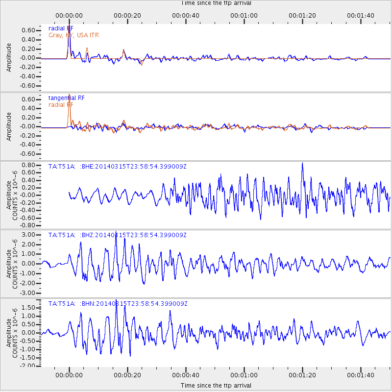
Signal To Noise
| Channel | StoN | STA | LTA |
| TA:T51A: :BHZ:20140315T23:58:54.399009Z | 5.9828334 | 9.57311E-7 | 1.6000965E-7 |
| TA:T51A: :BHN:20140315T23:58:54.399009Z | 3.364361 | 5.807696E-7 | 1.7262404E-7 |
| TA:T51A: :BHE:20140315T23:58:54.399009Z | 1.5116845 | 1.6648784E-7 | 1.1013398E-7 |
| Arrivals |
| Ps | 6.4 SECOND |
| PpPs | 19 SECOND |
| PsPs/PpSs | 25 SECOND |


