You are here: Home > Network List > TA - USArray Transportable Network (new EarthScope stations) Stations List
> Station POKR Poker Plat Research Range, AK, USA > Earthquake Result Viewer
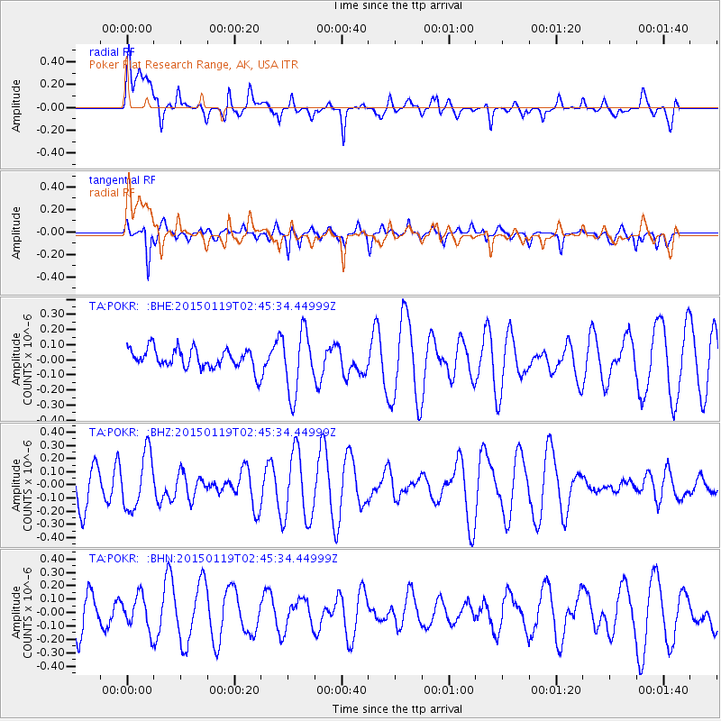
POKR Poker Plat Research Range, AK, USA - Earthquake Result Viewer
*The percent match for this event was below the threshold and hence no stack was calculated.
| Earthquake location: |
New Guinea, Papua New Guinea |
| Earthquake latitude/longitude: |
-6.2/145.3 |
| Earthquake time(UTC): |
2015/01/19 (019) 02:33:35 GMT |
| Earthquake Depth: |
100 km |
| Earthquake Magnitude: |
5.0 MW, 5.0 mb |
| Earthquake Catalog/Contributor: |
ISC/ISC |
|
| Network: |
TA USArray Transportable Network (new EarthScope stations) |
| Station: |
POKR Poker Plat Research Range, AK, USA |
| Lat/Lon: |
65.12 N/147.43 W |
| Elevation: |
501 m |
|
| Distance: |
86.2 deg |
| Az: |
23.028 deg |
| Baz: |
246.823 deg |
| Ray Param: |
$rayparam |
*The percent match for this event was below the threshold and hence was not used in the summary stack. |
|
| Radial Match: |
48.263233 % |
| Radial Bump: |
400 |
| Transverse Match: |
35.651436 % |
| Transverse Bump: |
299 |
| SOD ConfigId: |
3390531 |
| Insert Time: |
2019-04-16 02:41:26.641 +0000 |
| GWidth: |
2.5 |
| Max Bumps: |
400 |
| Tol: |
0.001 |
|
Signal To Noise
| Channel | StoN | STA | LTA |
| TA:POKR: :BHZ:20150119T02:45:34.44999Z | 1.1027162 | 2.1148436E-7 | 1.9178495E-7 |
| TA:POKR: :BHN:20150119T02:45:34.44999Z | 0.85664874 | 1.314194E-7 | 1.5341105E-7 |
| TA:POKR: :BHE:20150119T02:45:34.44999Z | 3.155839 | 2.0758284E-7 | 6.5777385E-8 |
| Arrivals |
| Ps | |
| PpPs | |
| PsPs/PpSs | |


