You are here: Home > Network List > UW - Pacific Northwest Regional Seismic Network Stations List
> Station MRBL Marblemount, WA, USA > Earthquake Result Viewer
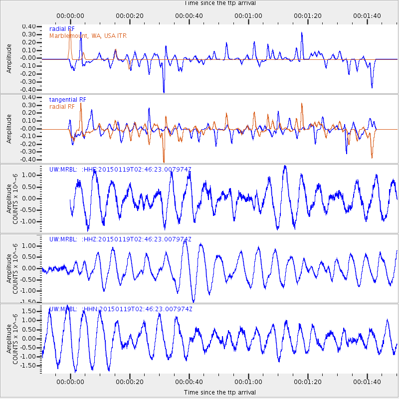
MRBL Marblemount, WA, USA - Earthquake Result Viewer
*The percent match for this event was below the threshold and hence no stack was calculated.
| Earthquake location: |
New Guinea, Papua New Guinea |
| Earthquake latitude/longitude: |
-6.2/145.3 |
| Earthquake time(UTC): |
2015/01/19 (019) 02:33:35 GMT |
| Earthquake Depth: |
100 km |
| Earthquake Magnitude: |
5.0 MW, 5.0 mb |
| Earthquake Catalog/Contributor: |
ISC/ISC |
|
| Network: |
UW Pacific Northwest Regional Seismic Network |
| Station: |
MRBL Marblemount, WA, USA |
| Lat/Lon: |
48.52 N/121.48 W |
| Elevation: |
75 m |
|
| Distance: |
96.7 deg |
| Az: |
41.944 deg |
| Baz: |
268.341 deg |
| Ray Param: |
$rayparam |
*The percent match for this event was below the threshold and hence was not used in the summary stack. |
|
| Radial Match: |
76.10909 % |
| Radial Bump: |
400 |
| Transverse Match: |
44.042183 % |
| Transverse Bump: |
391 |
| SOD ConfigId: |
3390531 |
| Insert Time: |
2019-04-16 02:41:50.266 +0000 |
| GWidth: |
2.5 |
| Max Bumps: |
400 |
| Tol: |
0.001 |
|
Signal To Noise
| Channel | StoN | STA | LTA |
| UW:MRBL: :HHZ:20150119T02:46:23.007974Z | 0.32917514 | 1.9062936E-7 | 5.791123E-7 |
| UW:MRBL: :HHN:20150119T02:46:23.007974Z | 2.368751 | 1.2781562E-6 | 5.395908E-7 |
| UW:MRBL: :HHE:20150119T02:46:23.007974Z | 1.1411928 | 6.83458E-7 | 5.9889794E-7 |
| Arrivals |
| Ps | |
| PpPs | |
| PsPs/PpSs | |


