You are here: Home > Network List > UW - Pacific Northwest Regional Seismic Network Stations List
> Station HOOD Mt Hood Meadows, OR CREST BB SMO > Earthquake Result Viewer
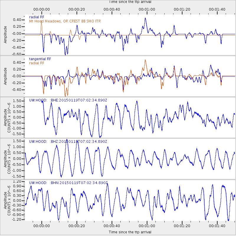
HOOD Mt Hood Meadows, OR CREST BB SMO - Earthquake Result Viewer
*The percent match for this event was below the threshold and hence no stack was calculated.
| Earthquake location: |
South Of Tonga Islands |
| Earthquake latitude/longitude: |
-25.1/-175.3 |
| Earthquake time(UTC): |
2015/01/19 (019) 06:50:28 GMT |
| Earthquake Depth: |
10 km |
| Earthquake Magnitude: |
3.8 mb |
| Earthquake Catalog/Contributor: |
ISC/ISC |
|
| Network: |
UW Pacific Northwest Regional Seismic Network |
| Station: |
HOOD Mt Hood Meadows, OR CREST BB SMO |
| Lat/Lon: |
45.32 N/121.65 W |
| Elevation: |
1520 m |
|
| Distance: |
85.5 deg |
| Az: |
34.766 deg |
| Baz: |
227.101 deg |
| Ray Param: |
$rayparam |
*The percent match for this event was below the threshold and hence was not used in the summary stack. |
|
| Radial Match: |
59.925922 % |
| Radial Bump: |
400 |
| Transverse Match: |
38.783318 % |
| Transverse Bump: |
400 |
| SOD ConfigId: |
3390531 |
| Insert Time: |
2019-04-16 02:47:43.012 +0000 |
| GWidth: |
2.5 |
| Max Bumps: |
400 |
| Tol: |
0.001 |
|
Signal To Noise
| Channel | StoN | STA | LTA |
| UW:HOOD: :BHZ:20150119T07:02:34.890Z | 1.8848964 | 6.0870747E-7 | 3.2293948E-7 |
| UW:HOOD: :BHN:20150119T07:02:34.890Z | 1.2491338 | 4.9436585E-7 | 3.9576693E-7 |
| UW:HOOD: :BHE:20150119T07:02:34.890Z | 1.7864604 | 1.2214946E-6 | 6.837513E-7 |
| Arrivals |
| Ps | |
| PpPs | |
| PsPs/PpSs | |


