You are here: Home > Network List > TA - USArray Transportable Network (new EarthScope stations) Stations List
> Station S56A Natural Bridge, VA, USA > Earthquake Result Viewer
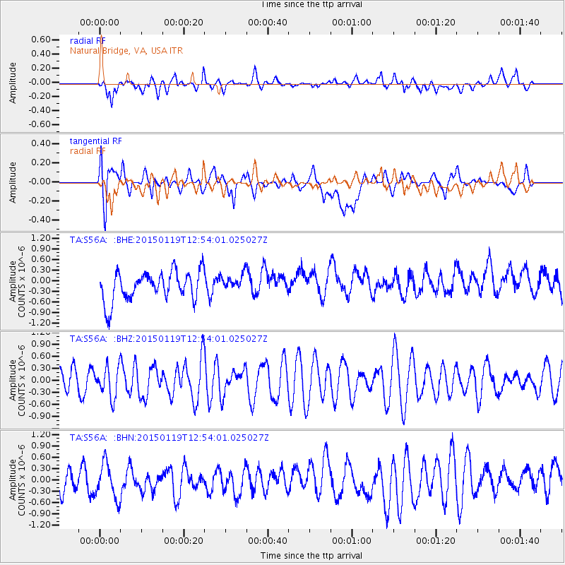
S56A Natural Bridge, VA, USA - Earthquake Result Viewer
*The percent match for this event was below the threshold and hence no stack was calculated.
| Earthquake location: |
Greenland Sea |
| Earthquake latitude/longitude: |
73.2/6.4 |
| Earthquake time(UTC): |
2015/01/19 (019) 12:45:13 GMT |
| Earthquake Depth: |
10 km |
| Earthquake Magnitude: |
5.5 MB |
| Earthquake Catalog/Contributor: |
NEIC PDE/NEIC COMCAT |
|
| Network: |
TA USArray Transportable Network (new EarthScope stations) |
| Station: |
S56A Natural Bridge, VA, USA |
| Lat/Lon: |
37.68 N/79.57 W |
| Elevation: |
449 m |
|
| Distance: |
53.2 deg |
| Az: |
278.892 deg |
| Baz: |
21.193 deg |
| Ray Param: |
$rayparam |
*The percent match for this event was below the threshold and hence was not used in the summary stack. |
|
| Radial Match: |
53.4142 % |
| Radial Bump: |
400 |
| Transverse Match: |
51.262474 % |
| Transverse Bump: |
400 |
| SOD ConfigId: |
3390531 |
| Insert Time: |
2019-04-16 02:55:34.697 +0000 |
| GWidth: |
2.5 |
| Max Bumps: |
400 |
| Tol: |
0.001 |
|
Signal To Noise
| Channel | StoN | STA | LTA |
| TA:S56A: :BHZ:20150119T12:54:01.025027Z | 0.96580845 | 3.845614E-7 | 3.9817564E-7 |
| TA:S56A: :BHN:20150119T12:54:01.025027Z | 1.3809797 | 4.9544536E-7 | 3.5876369E-7 |
| TA:S56A: :BHE:20150119T12:54:01.025027Z | 0.5366116 | 2.1738683E-7 | 4.0511017E-7 |
| Arrivals |
| Ps | |
| PpPs | |
| PsPs/PpSs | |


