You are here: Home > Network List > KN - Kyrgyz Seismic Telemetry Network Stations List
> Station TKM2 - > Earthquake Result Viewer
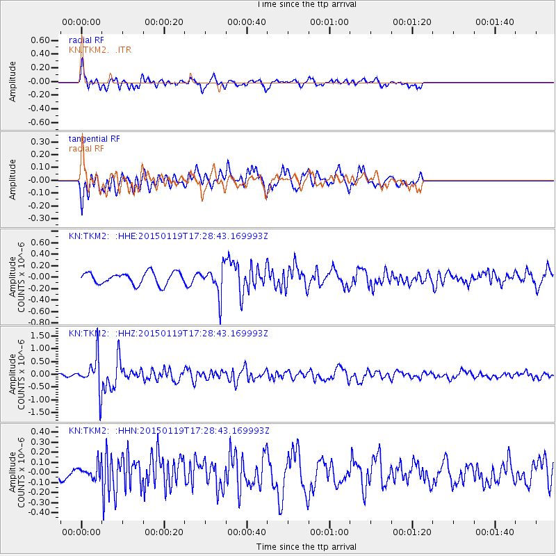
TKM2 - - Earthquake Result Viewer
*The percent match for this event was below the threshold and hence no stack was calculated.
| Earthquake location: |
Sulu Archipelago, Philippines |
| Earthquake latitude/longitude: |
4.6/119.8 |
| Earthquake time(UTC): |
2015/01/19 (019) 17:19:45 GMT |
| Earthquake Depth: |
11 km |
| Earthquake Magnitude: |
5.5 MWB |
| Earthquake Catalog/Contributor: |
NEIC PDE/NEIC COMCAT |
|
| Network: |
KN Kyrgyz Seismic Telemetry Network |
| Station: |
TKM2 - |
| Lat/Lon: |
42.92 N/75.60 E |
| Elevation: |
2020 m |
|
| Distance: |
54.6 deg |
| Az: |
321.095 deg |
| Baz: |
121.546 deg |
| Ray Param: |
$rayparam |
*The percent match for this event was below the threshold and hence was not used in the summary stack. |
|
| Radial Match: |
67.79572 % |
| Radial Bump: |
400 |
| Transverse Match: |
67.31023 % |
| Transverse Bump: |
400 |
| SOD ConfigId: |
3390531 |
| Insert Time: |
2019-04-16 03:06:33.485 +0000 |
| GWidth: |
2.5 |
| Max Bumps: |
400 |
| Tol: |
0.001 |
|
Signal To Noise
| Channel | StoN | STA | LTA |
| KN:TKM2: :HHZ:20150119T17:28:43.169993Z | 10.14003 | 6.875833E-7 | 6.7808806E-8 |
| KN:TKM2: :HHN:20150119T17:28:43.169993Z | 1.0556135 | 8.4144894E-8 | 7.971183E-8 |
| KN:TKM2: :HHE:20150119T17:28:43.169993Z | 2.3933117 | 2.490283E-7 | 1.04051765E-7 |
| Arrivals |
| Ps | |
| PpPs | |
| PsPs/PpSs | |


