You are here: Home > Network List > TA - USArray Transportable Network (new EarthScope stations) Stations List
> Station J01E Myrtle Point, OR, USA > Earthquake Result Viewer
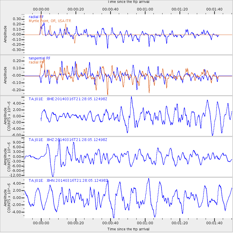
J01E Myrtle Point, OR, USA - Earthquake Result Viewer
*The percent match for this event was below the threshold and hence no stack was calculated.
| Earthquake location: |
Near Coast Of Northern Chile |
| Earthquake latitude/longitude: |
-19.9/-70.6 |
| Earthquake time(UTC): |
2014/03/16 (075) 21:16:30 GMT |
| Earthquake Depth: |
20 km |
| Earthquake Magnitude: |
6.7 MWW, 6.7 MWC, 7.0 MI |
| Earthquake Catalog/Contributor: |
NEIC PDE/NEIC COMCAT |
|
| Network: |
TA USArray Transportable Network (new EarthScope stations) |
| Station: |
J01E Myrtle Point, OR, USA |
| Lat/Lon: |
43.16 N/123.93 W |
| Elevation: |
128 m |
|
| Distance: |
79.6 deg |
| Az: |
323.381 deg |
| Baz: |
129.915 deg |
| Ray Param: |
$rayparam |
*The percent match for this event was below the threshold and hence was not used in the summary stack. |
|
| Radial Match: |
66.39431 % |
| Radial Bump: |
400 |
| Transverse Match: |
72.15417 % |
| Transverse Bump: |
381 |
| SOD ConfigId: |
626651 |
| Insert Time: |
2014-04-21 07:36:15.753 +0000 |
| GWidth: |
2.5 |
| Max Bumps: |
400 |
| Tol: |
0.001 |
|
Signal To Noise
| Channel | StoN | STA | LTA |
| TA:J01E: :BHZ:20140316T21:28:05.12498Z | 2.5471897 | 3.821968E-6 | 1.5004647E-6 |
| TA:J01E: :BHN:20140316T21:28:05.12498Z | 1.7115761 | 1.8975334E-6 | 1.1086468E-6 |
| TA:J01E: :BHE:20140316T21:28:05.12498Z | 1.312193 | 1.0985622E-6 | 8.3719556E-7 |
| Arrivals |
| Ps | |
| PpPs | |
| PsPs/PpSs | |


