You are here: Home > Network List > TA - USArray Transportable Network (new EarthScope stations) Stations List
> Station J48A Bridge Port, MI, USA > Earthquake Result Viewer
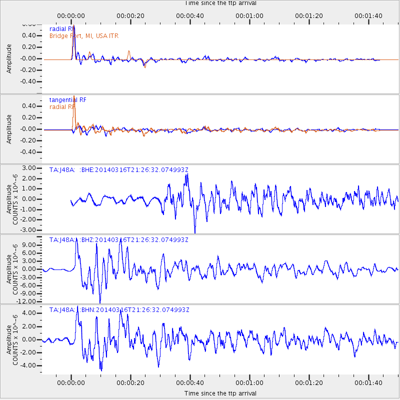
J48A Bridge Port, MI, USA - Earthquake Result Viewer
*The percent match for this event was below the threshold and hence no stack was calculated.
| Earthquake location: |
Near Coast Of Northern Chile |
| Earthquake latitude/longitude: |
-19.9/-70.6 |
| Earthquake time(UTC): |
2014/03/16 (075) 21:16:30 GMT |
| Earthquake Depth: |
20 km |
| Earthquake Magnitude: |
6.7 MWW, 6.7 MWC, 7.0 MI |
| Earthquake Catalog/Contributor: |
NEIC PDE/NEIC COMCAT |
|
| Network: |
TA USArray Transportable Network (new EarthScope stations) |
| Station: |
J48A Bridge Port, MI, USA |
| Lat/Lon: |
43.30 N/82.78 W |
| Elevation: |
195 m |
|
| Distance: |
63.9 deg |
| Az: |
350.141 deg |
| Baz: |
167.253 deg |
| Ray Param: |
$rayparam |
*The percent match for this event was below the threshold and hence was not used in the summary stack. |
|
| Radial Match: |
95.902214 % |
| Radial Bump: |
400 |
| Transverse Match: |
78.0077 % |
| Transverse Bump: |
400 |
| SOD ConfigId: |
626651 |
| Insert Time: |
2014-04-21 07:36:30.457 +0000 |
| GWidth: |
2.5 |
| Max Bumps: |
400 |
| Tol: |
0.001 |
|
Signal To Noise
| Channel | StoN | STA | LTA |
| TA:J48A: :BHZ:20140316T21:26:32.074993Z | 13.49127 | 4.94253E-6 | 3.663502E-7 |
| TA:J48A: :BHN:20140316T21:26:32.074993Z | 9.802973 | 2.1793896E-6 | 2.2231924E-7 |
| TA:J48A: :BHE:20140316T21:26:32.074993Z | 2.4556398 | 7.1376104E-7 | 2.9066194E-7 |
| Arrivals |
| Ps | |
| PpPs | |
| PsPs/PpSs | |


