You are here: Home > Network List > TA - USArray Transportable Network (new EarthScope stations) Stations List
> Station P53A Whipple, OH, USA > Earthquake Result Viewer
P53A Whipple, OH, USA - Earthquake Result Viewer

| Earthquake location: |
Near Coast Of Northern Chile |
| Earthquake latitude/longitude: |
-19.9/-70.6 |
| Earthquake time(UTC): |
2014/03/16 (075) 21:16:30 GMT |
| Earthquake Depth: |
20 km |
| Earthquake Magnitude: |
6.7 MWW, 6.7 MWC, 7.0 MI |
| Earthquake Catalog/Contributor: |
NEIC PDE/NEIC COMCAT |
|
| Network: |
TA USArray Transportable Network (new EarthScope stations) |
| Station: |
P53A Whipple, OH, USA |
| Lat/Lon: |
39.49 N/81.39 W |
| Elevation: |
270 m |
|
| Distance: |
60.0 deg |
| Az: |
350.39 deg |
| Baz: |
168.29 deg |
| Ray Param: |
0.061829474 |
| Estimated Moho Depth: |
38.25 km |
| Estimated Crust Vp/Vs: |
2.09 |
| Assumed Crust Vp: |
6.207 km/s |
| Estimated Crust Vs: |
2.973 km/s |
| Estimated Crust Poisson's Ratio: |
0.35 |
|
| Radial Match: |
93.83788 % |
| Radial Bump: |
397 |
| Transverse Match: |
79.25925 % |
| Transverse Bump: |
400 |
| SOD ConfigId: |
626651 |
| Insert Time: |
2014-04-21 07:41:56.424 +0000 |
| GWidth: |
2.5 |
| Max Bumps: |
400 |
| Tol: |
0.001 |
|
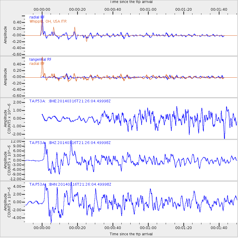
Signal To Noise
| Channel | StoN | STA | LTA |
| TA:P53A: :BHZ:20140316T21:26:04.49998Z | 18.655628 | 5.283851E-6 | 2.8323095E-7 |
| TA:P53A: :BHN:20140316T21:26:04.49998Z | 9.701719 | 2.441771E-6 | 2.5168436E-7 |
| TA:P53A: :BHE:20140316T21:26:04.49998Z | 1.9794418 | 4.2920146E-7 | 2.1682955E-7 |
| Arrivals |
| Ps | 7.0 SECOND |
| PpPs | 18 SECOND |
| PsPs/PpSs | 25 SECOND |


